UNC CHARLOTTE STORMWATER MASTERPLAN
PROJECT DETAILS
LOCATION: CHARLOTTE, NC
WHEN: 2018-2021
TYPE OF WORK: PROFESSIONAL
ROLE: DESIGNER
LANDSCAPE TEAM: ROBERT PRATT
CLIENT: UNC CHARLOTTE
DESIGN PHASE: AP
CONSULTANT TEAM: WILDLANDS ENGINEERING
AWARDS: 2022 NC ASLA MERIT AWARD
From the inception of the project in 2018 until its completion in 2021, I was the primary designer working on a stormwater masterplan for the University of North Carolina at Charlotte (UNCC). This was under the direction of Robert Pratt, the project manager and in coordination with Aaron Earley, from Wildlands Engineering.
The purpose of the stormwater masterplan is to bring the university into compliance with the City of Charlotte’s Post-Construction Stormwater Ordinance, which has the purpose of protecting, maintaining, and enhancing public health, safety, and environment by controlling the adverse effects of post-construction stormwater runoff and non-point source pollution associated with development. Due to increased campus development at UNCC in recent decades, the university was found non-compliant with the ordinance.
In addition to gaining compliance, the stormwater masterplan presents opportunities for additional stormwater management devices that surpass compliance minimums and provide a surplus of stormwater treatment that accounts for future campus development. Finally, the proposed stormwater control measures (SCMS) do not solely function as stormwater treatment devices, instead they offer holistic benefits as new amenity spaces that endow the campus with beautiful places for leisure, education, contemplation of nature, and provide new habitats that support rich ecosystems.
I spent many hours working on this project, which involved thorough site analysis and an implementation plan with some preliminary designs for specific interventions. I’ve detailed a bit of the process in the pages that follow.
EXISTING CONDITIONS AND FUTURE DEVELOPMENT
A major portion of this project consisted in determining the university’s needs. We needed to understand how the existing stormwater management systems on campus were performing and how the university envisioned future development.
The City of Charlotte determined that all buildings constructed on UNCC’s campus since 2008 have untreated built-upon-area (BUA) that needs to be treated for water quality. The existing conditions campus map identifies all the existing projects with untreated BUA. We went as far as determining the square footage of BUA that needed to be treated per building.
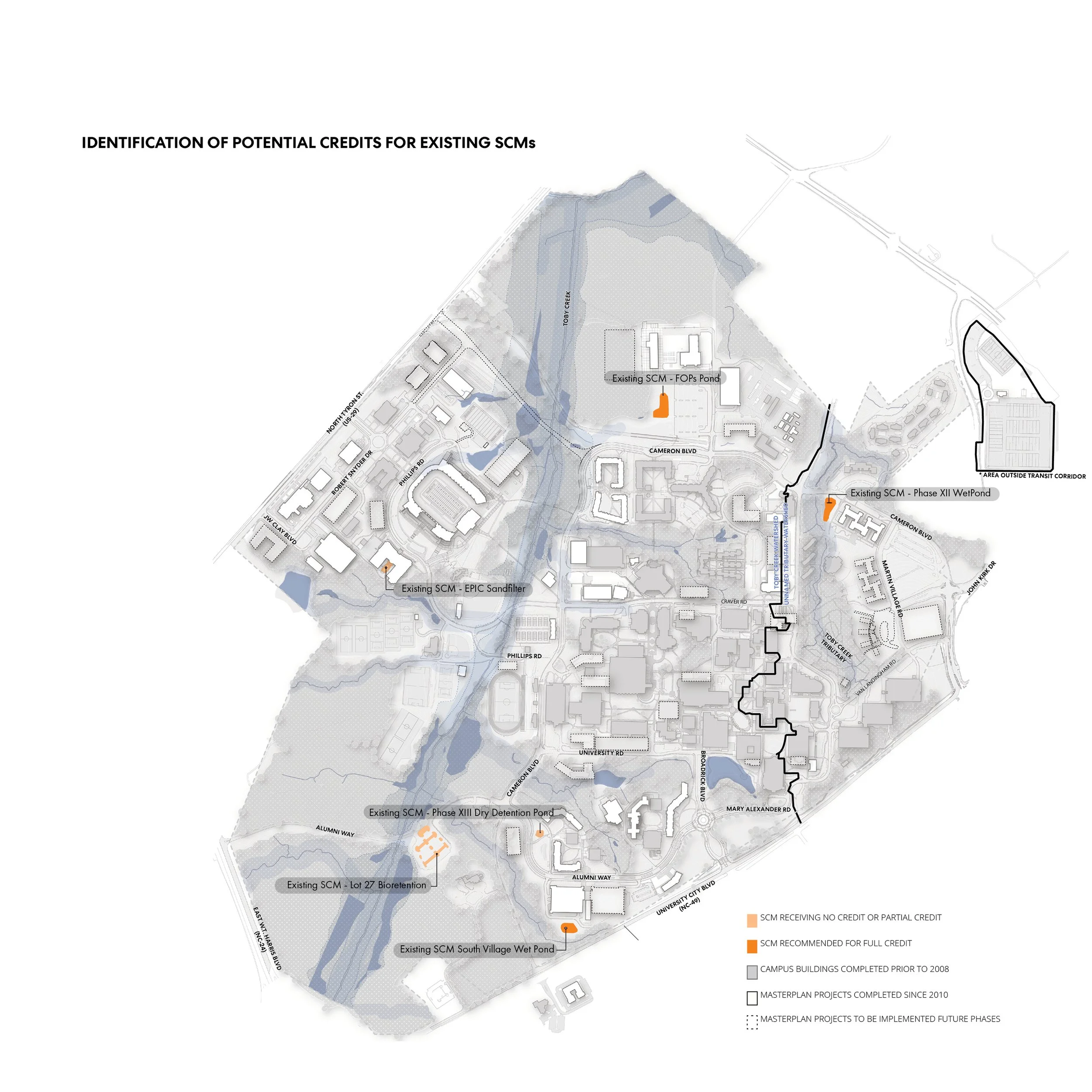
The university does have some existing stormwater control measures (SCMs) on campus, but most of these aren’t meeting the City of Charlotte’s water quality goals, so they don’t get full credit. The design team investigated the existing SCMs and made recommendations on how to maximize their functionality. The BUA that is treated by existing SCMs is considered and is subtracted from the total amount of BUA that would need to be treated by new SCMs.
After an evaluation, it was determined that the university needed to treat and/or detain stormwater from a total of 79.6 acres of BUA. Furthermore, the full realization of the University’s 2012 Masterplan would require that an additional 15.9 acres of BUA be treated.
A note about these graphics:
I created these easy-to-read illustrative campus base maps (one showing existing conditions on campus and another showing future conditions based on the university’s masterplan). It was a painstaking process that involved a close inspection of the 2012 master plan and frequent check-ins with university representatives.
To make these graphics I used a combination of QGIS, AutoCAD, Microsoft Excel, and Adobe Illustrator and InDesign.
CAMPUS DRAINAGE BASINS
There are three drainage basin areas on campus. We identified those as: East, West, and Northeast Recreational Fields. The ordinance stipulated that the university needed to treat the built upon area (BUA) within the drainage basin it is part of to receive credit.
Below is a breakdown of the BUA to be treated per drainage basin:
East Campus Basin
9.16 ac | BUA constructed post July 2008
2.82 ac | treated by existing SCMs
6.34 ac | not treated
-0.53 ac | net change in BUA from future development
5.81 ac | total BUA needing treatment
West Campus Basin
82.11 ac | BUA constructed post July 2008
21.65 ac | treated by existing SCMs
60.46 ac | not treated
+15.88 ac | net change in BUA from future development
76.34 ac | total BUA needing treatment
Northeast Recreational Fields Basin
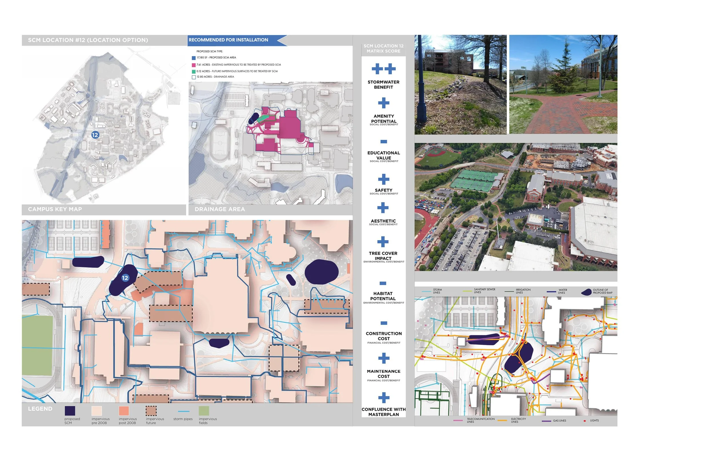
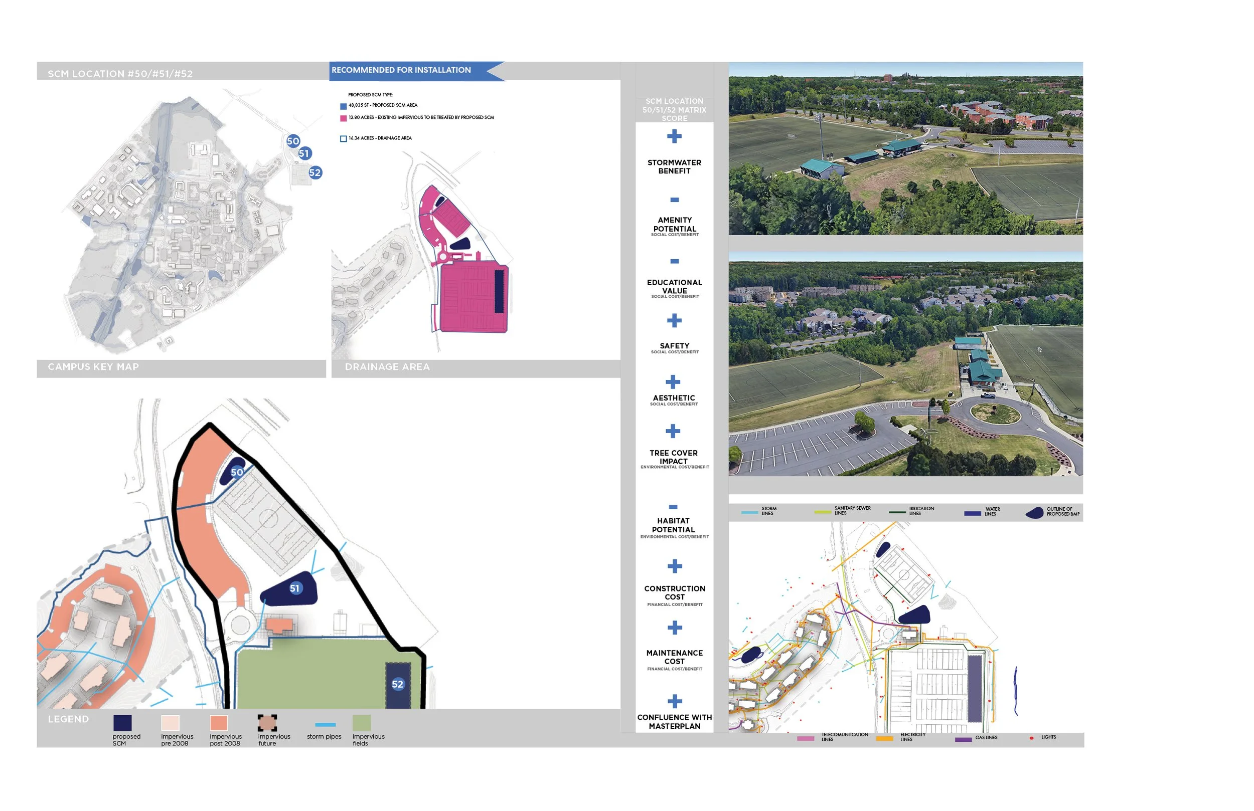
12.80 ac | BUA constructed post July 2008
0 ac | treated by existing SCMs
12.80 ac | not treated
0 ac | net change in BUA from future development
12.80 ac | total BUA needing treatment
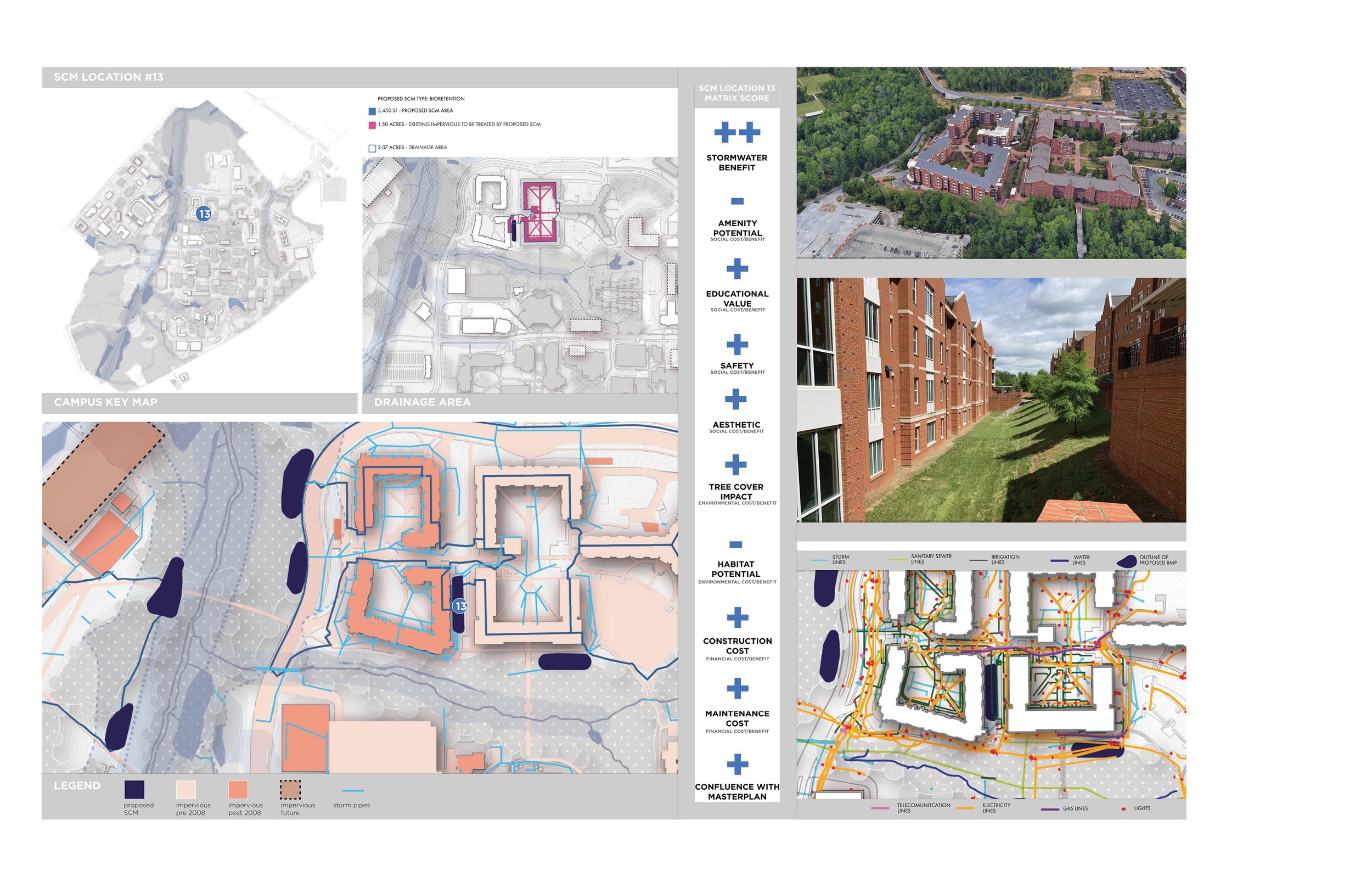
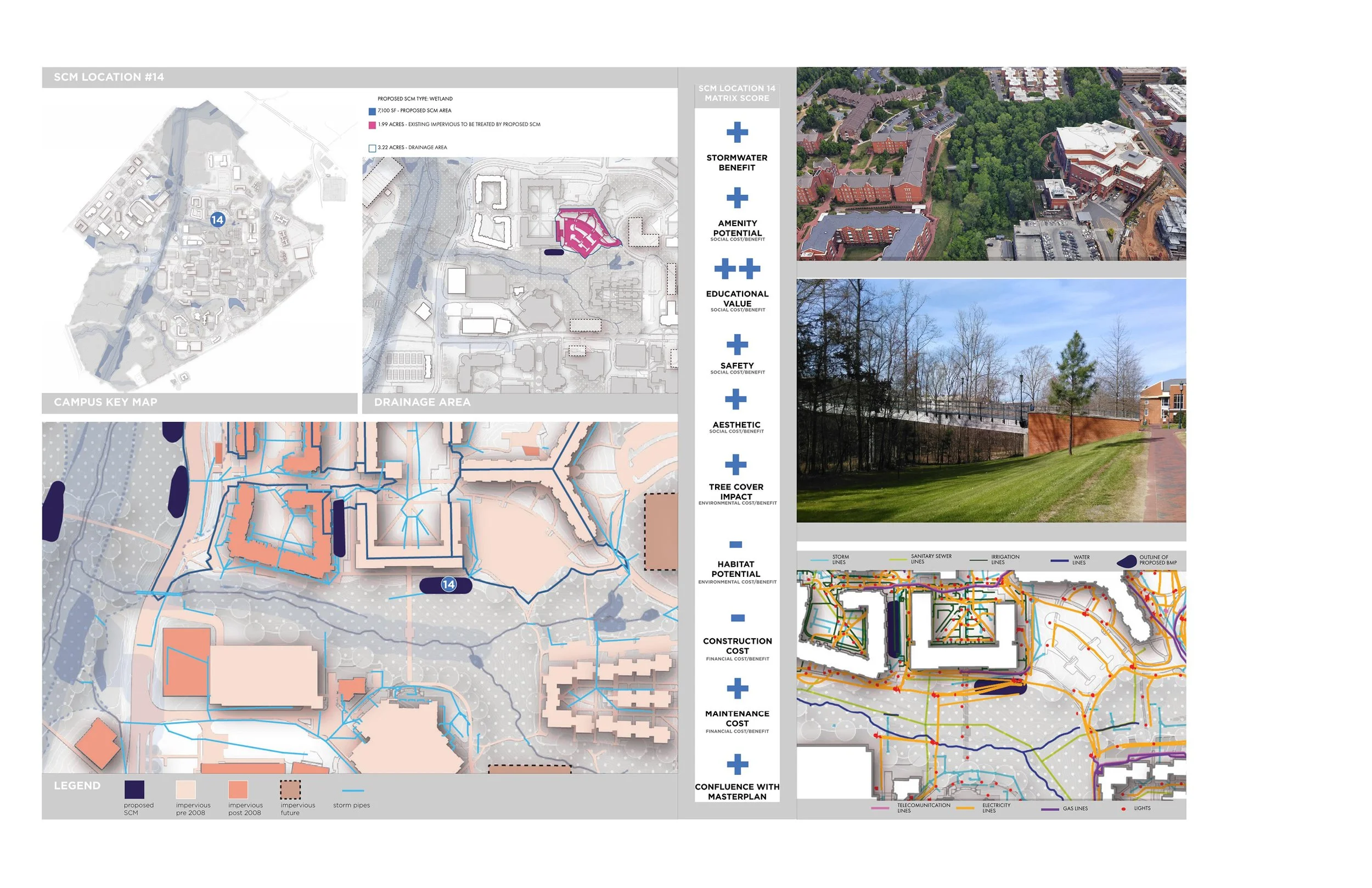
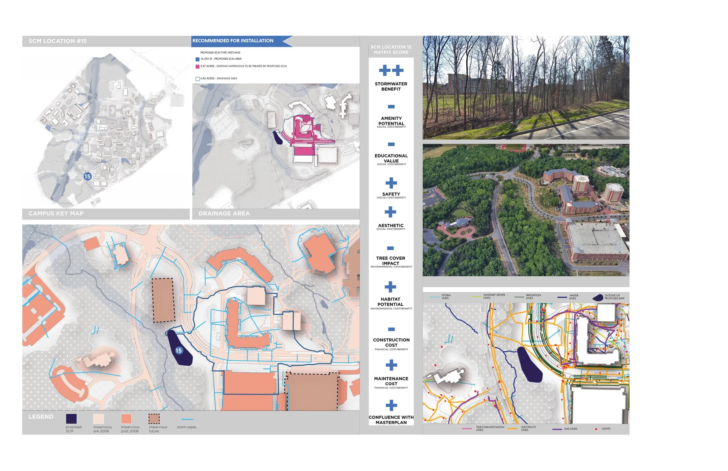
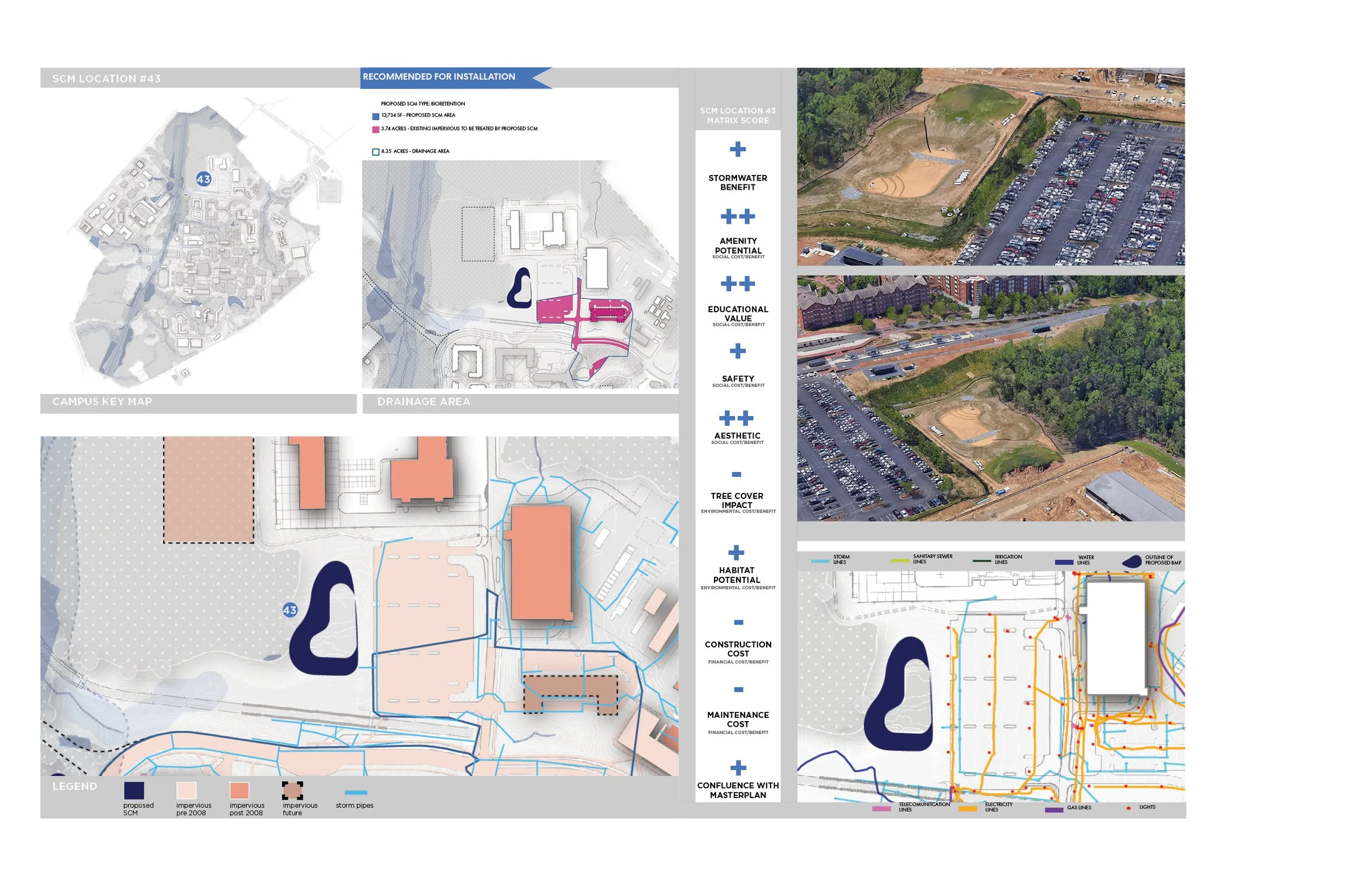
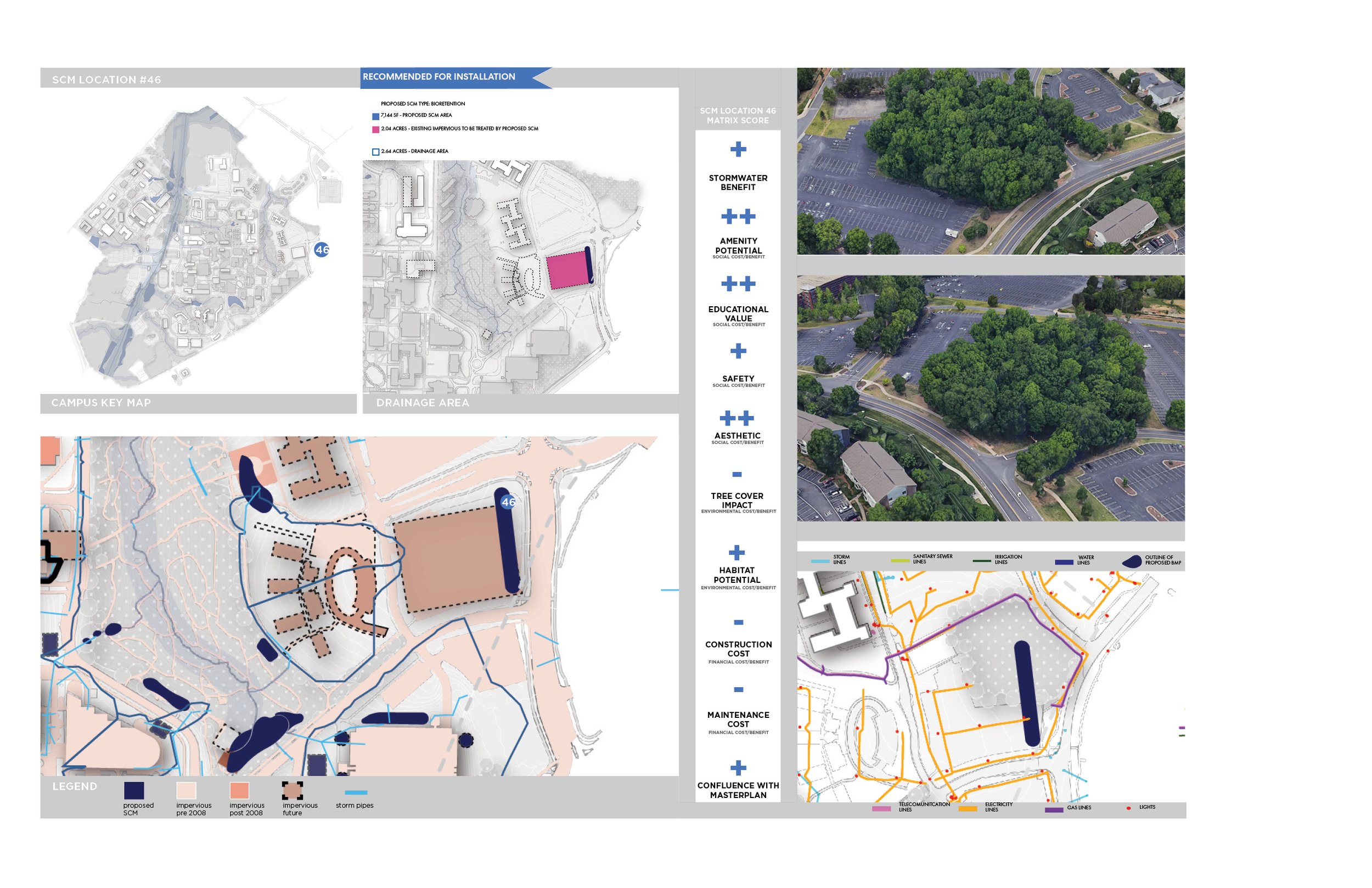
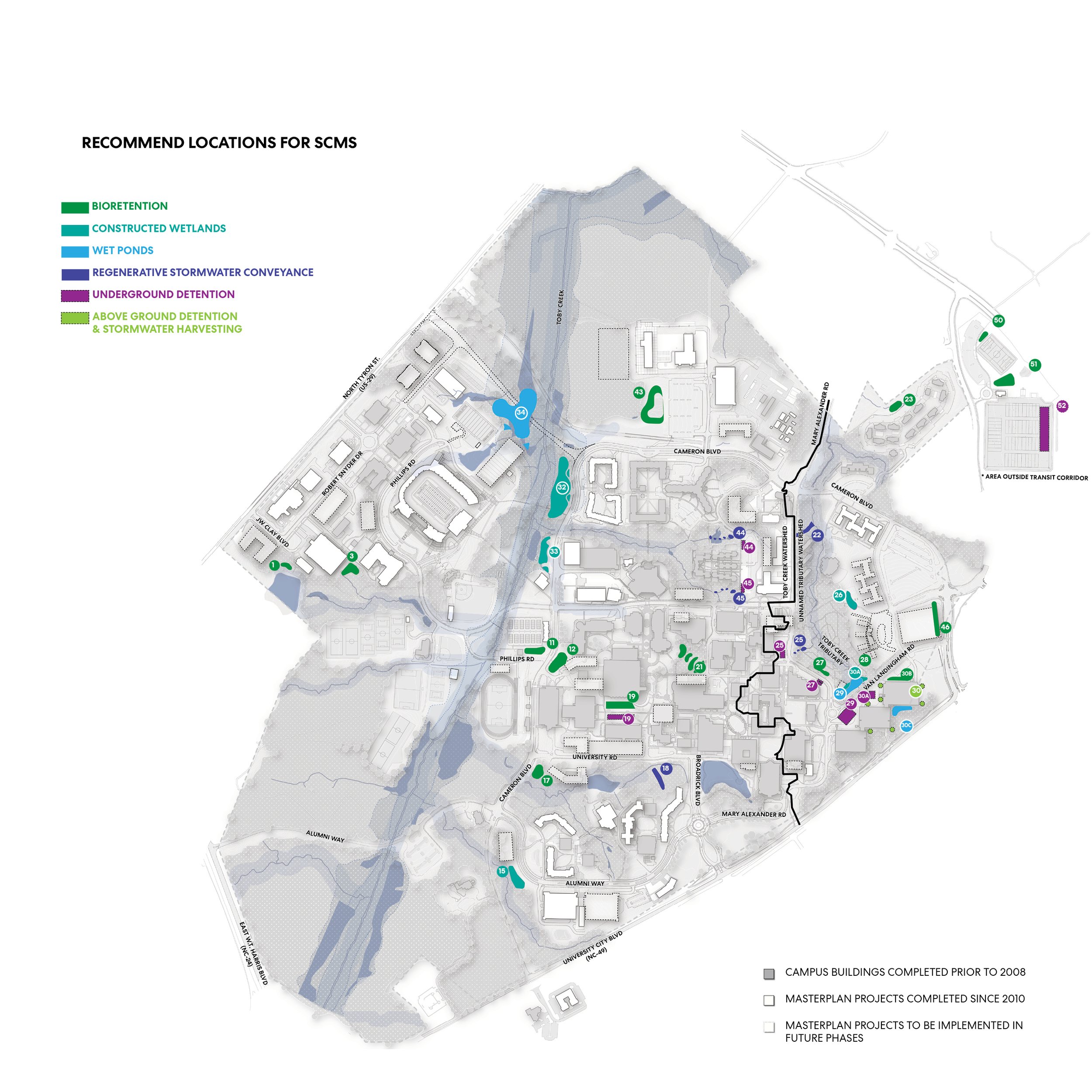
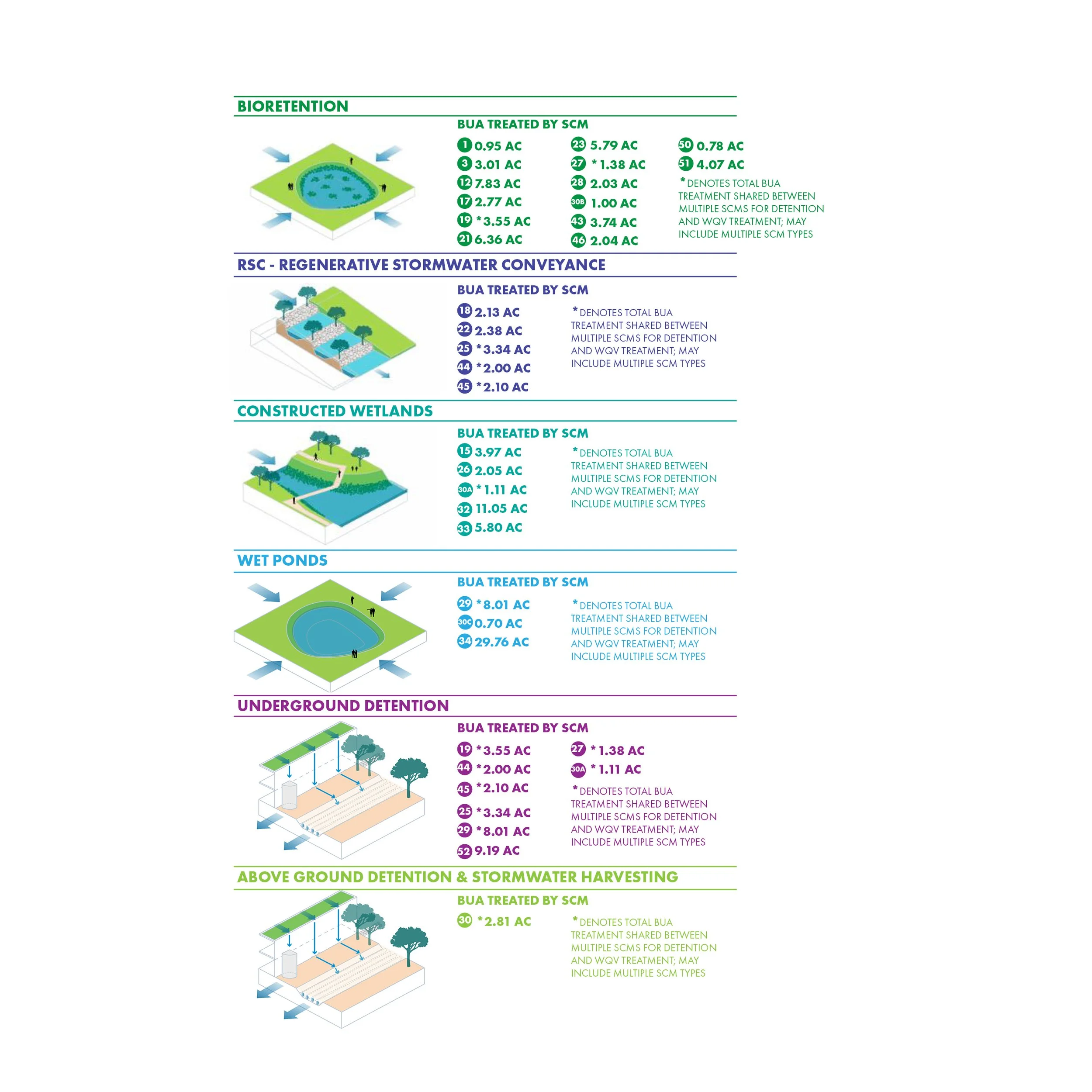
The way to treat and detain stormwater is through the installation of stormwater control measures (SCMs). A variety of SCM types were recommended throughout campus, such as bioretention areas, regenerative stormwater conveyance, constructed wetlands, wet ponds, underground detention areas, and stormwater harvesting devices. The graphic illustrations below show the types of SCMs recommended for the campus.
DATA COLLECTION, MAPPING AND CAMPUS SITE ANALYSIS
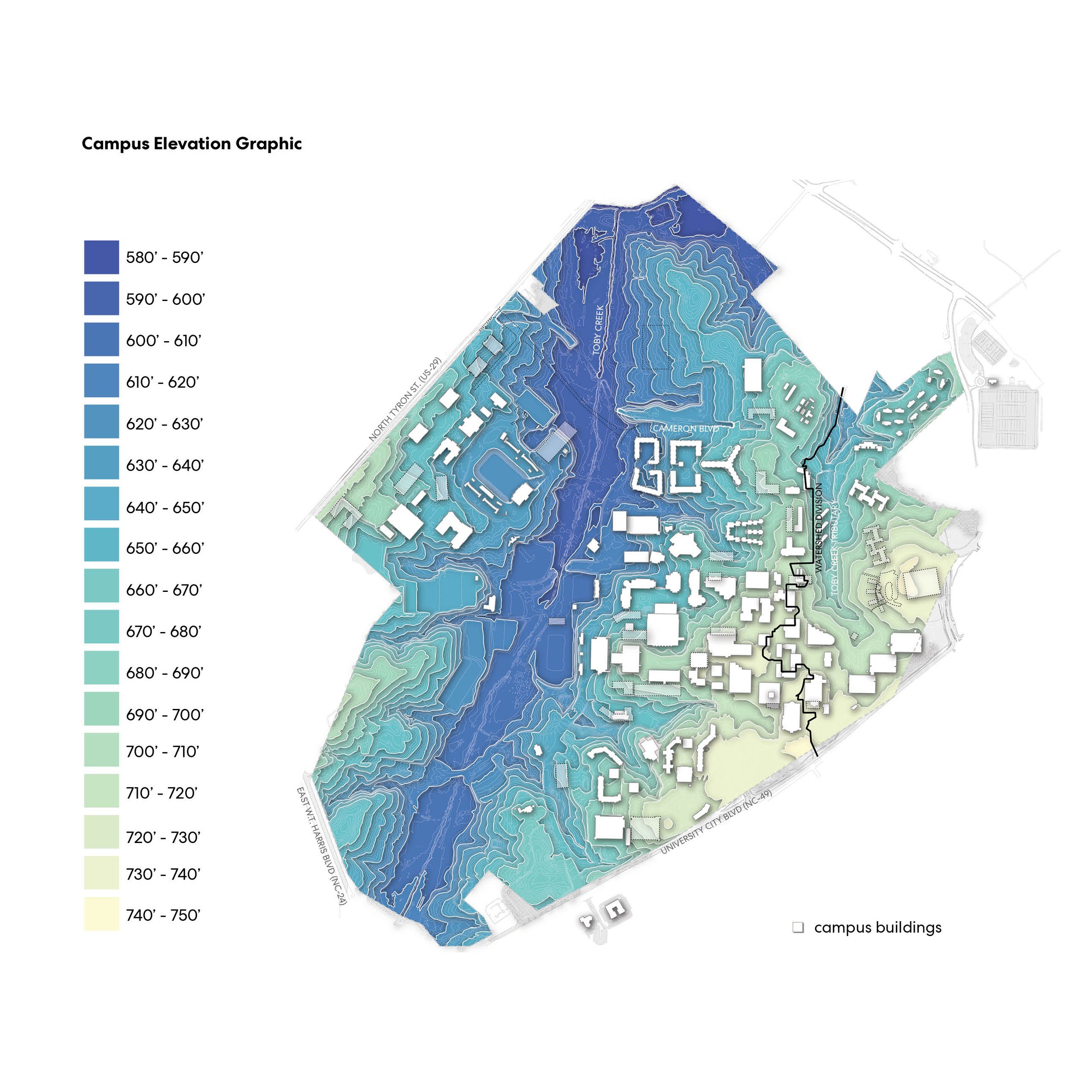
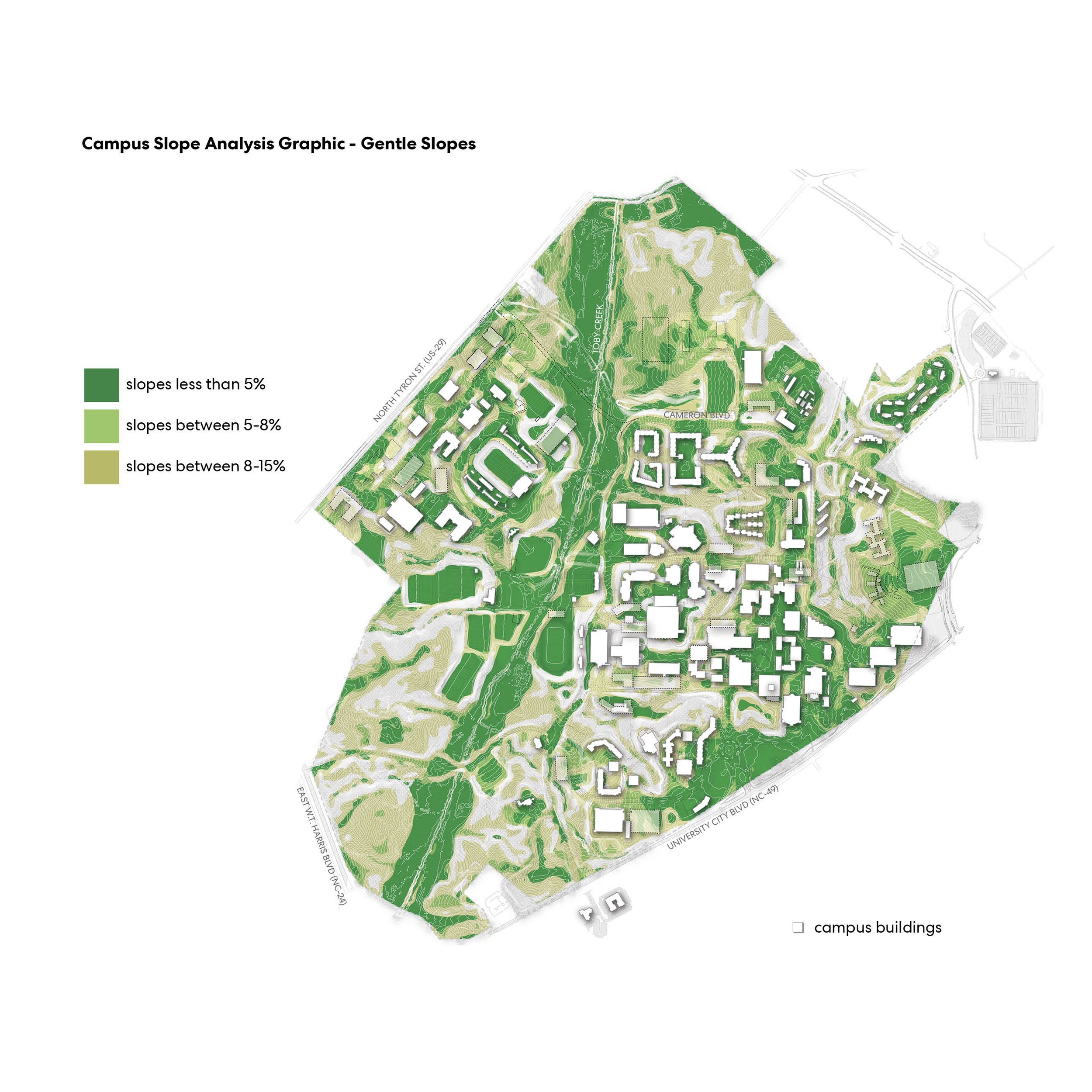
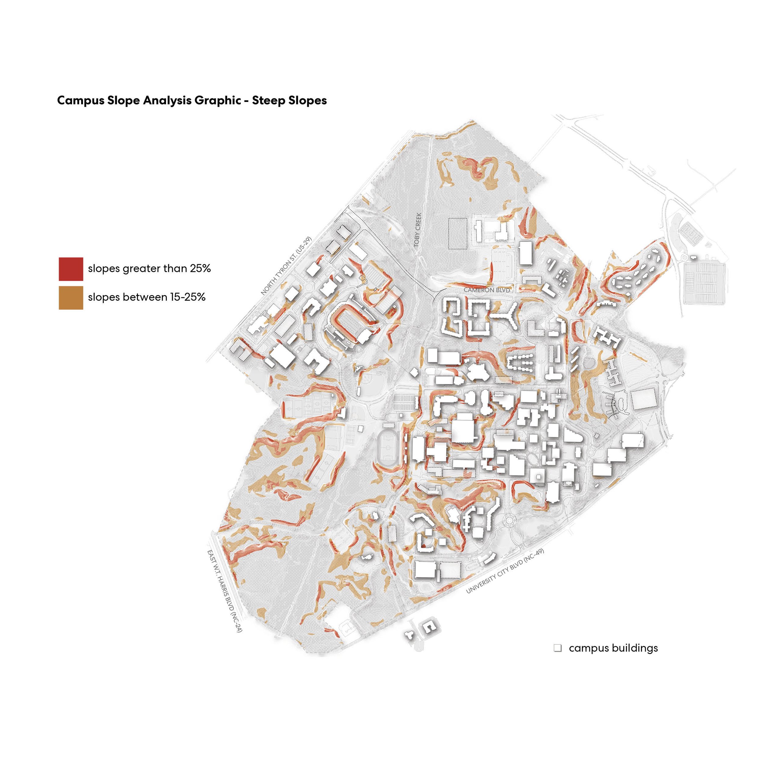
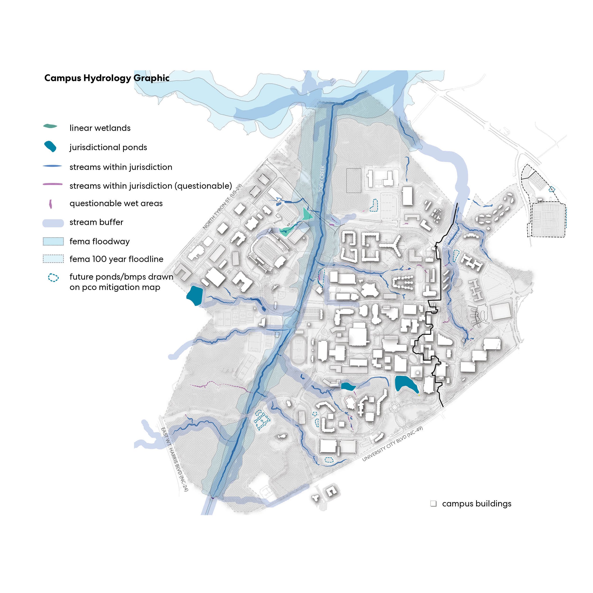
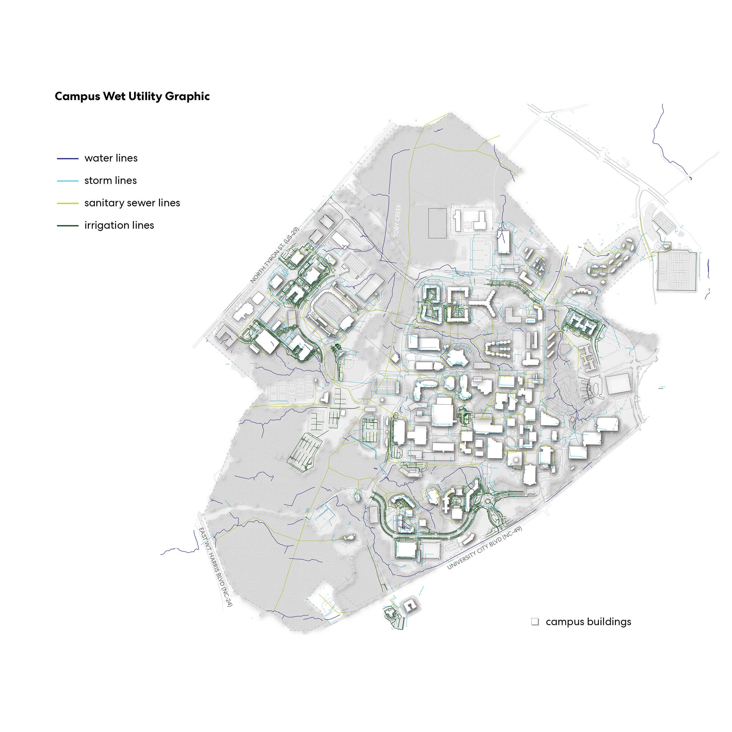
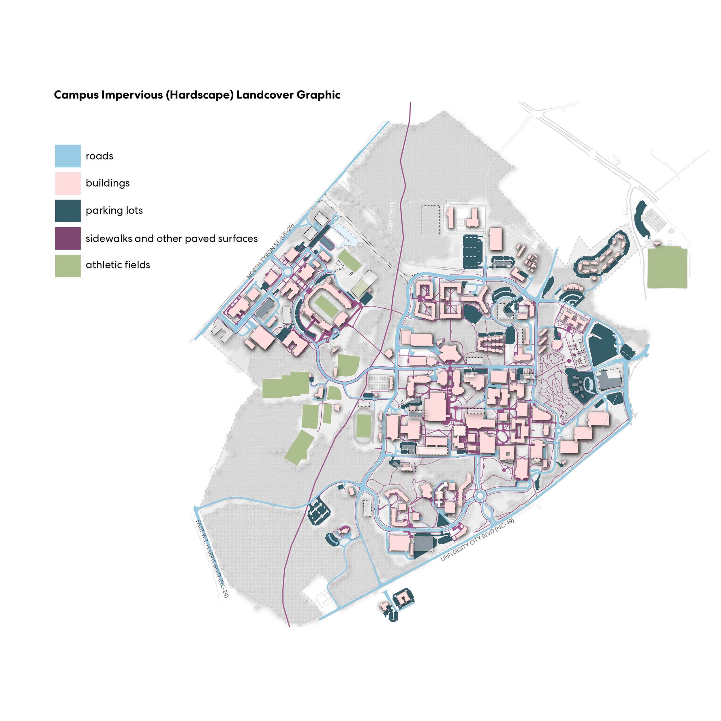
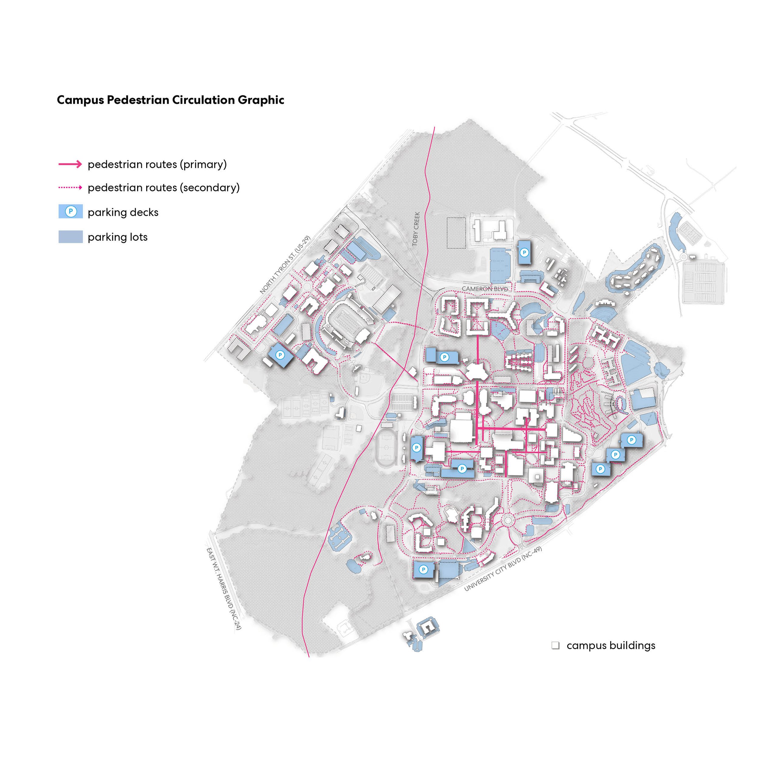
For this phase of the project, the design team went on several site visits to get a better understanding of the existing conditions on campus. I also collected and processed shapefile data sourced from the university and Mecklenburg County’s GIS database. I used QGIS to map the data and then took the maps into Adobe Illustrator to refine the graphics. We looked at the hydrological systems throughout campus, topography (including elevation and slopes), pedestrian and vehicular circulation patterns, utilities, land use and impervious surfaces. We used our site inventory and analysis maps to inform our decisions about potential opportunities for stormwater management. Shown on this page is a selection of campus maps I created to visulize the various site features we would consider in our proposed solutions.



IDENTIFYING STORMWATER MANAGEMENT SOLUTIONS
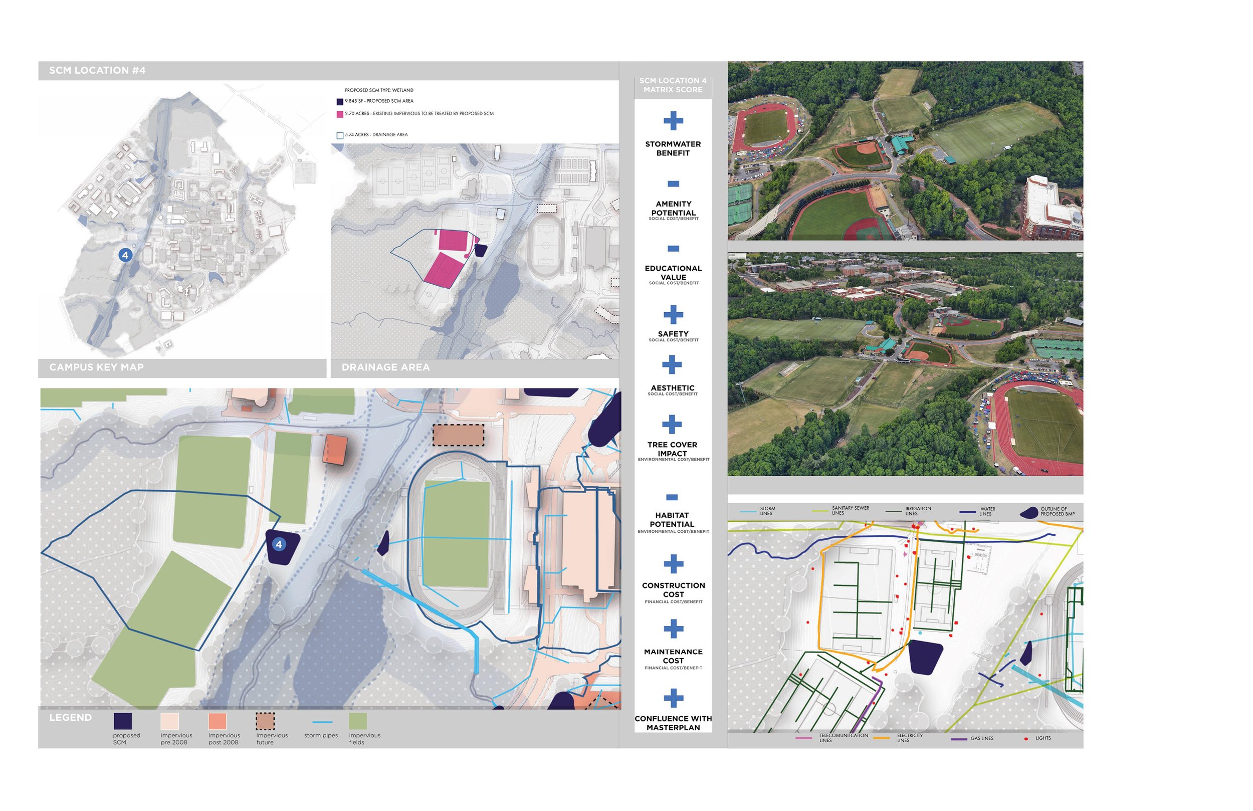
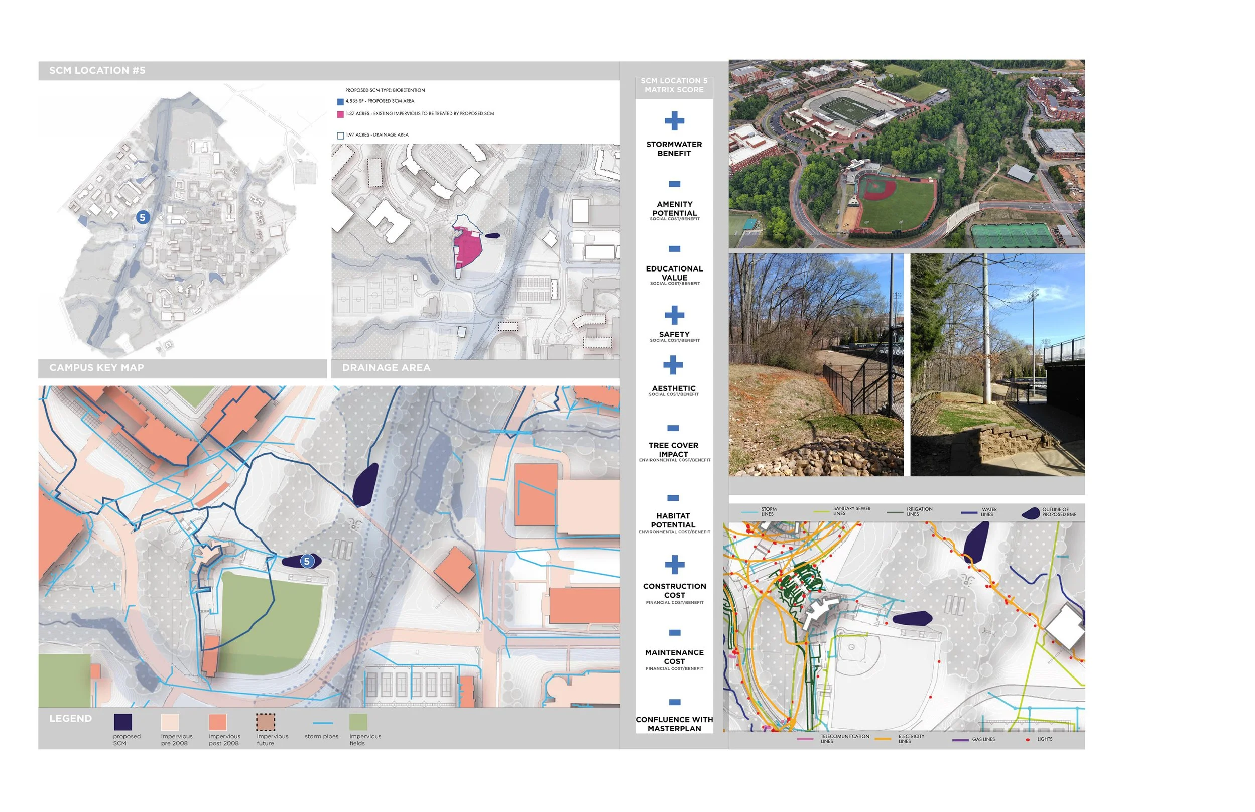
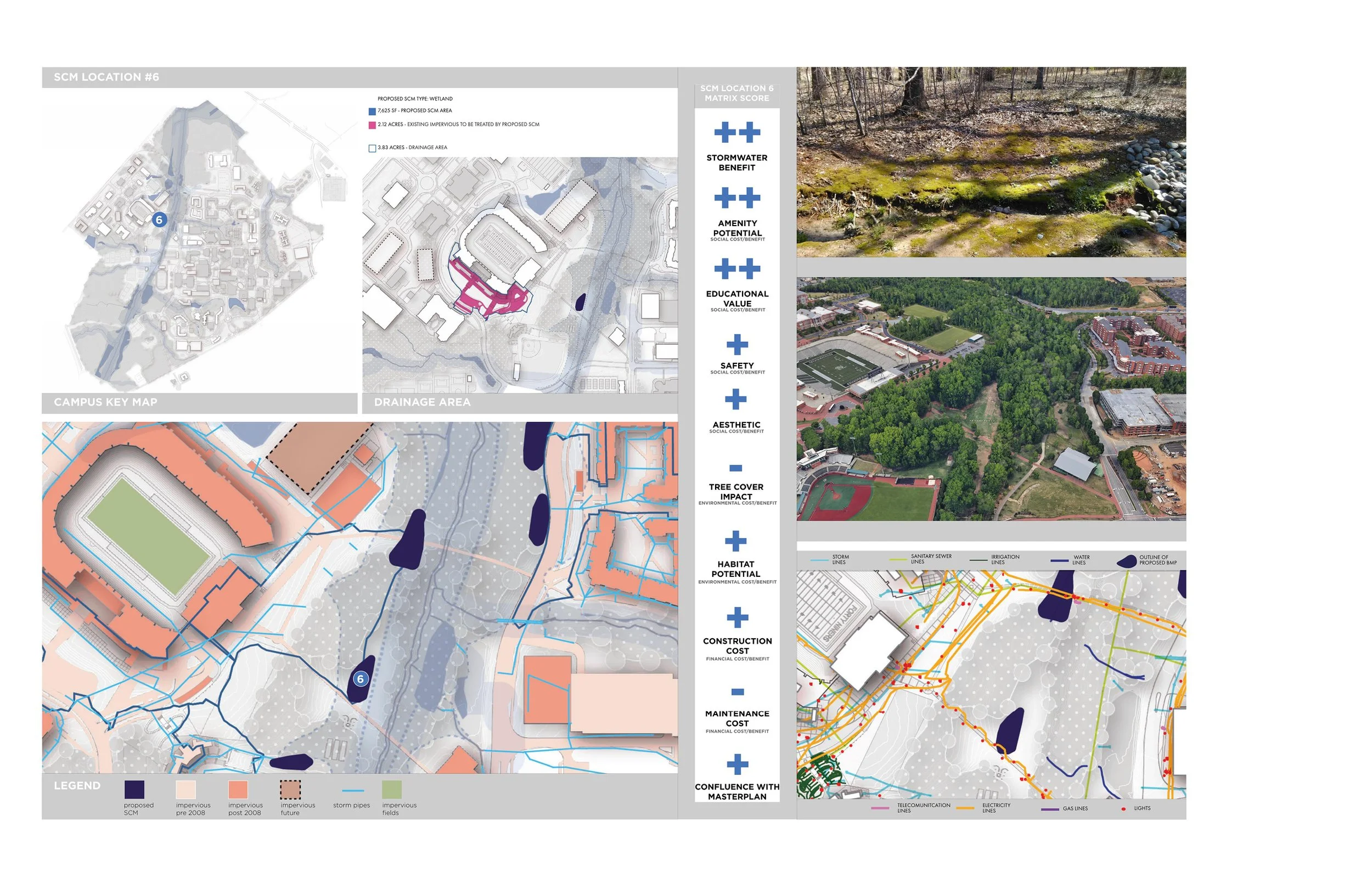
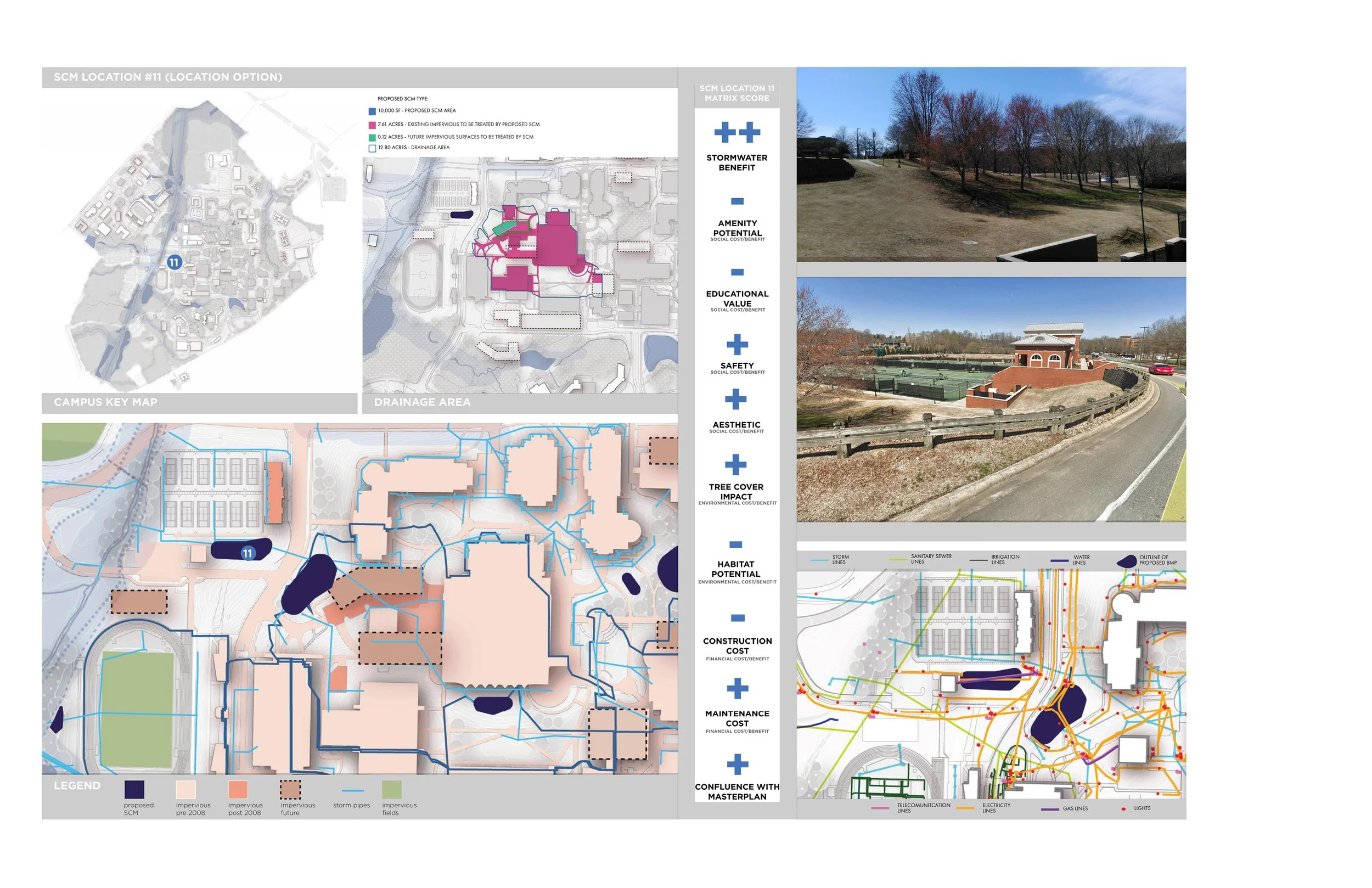
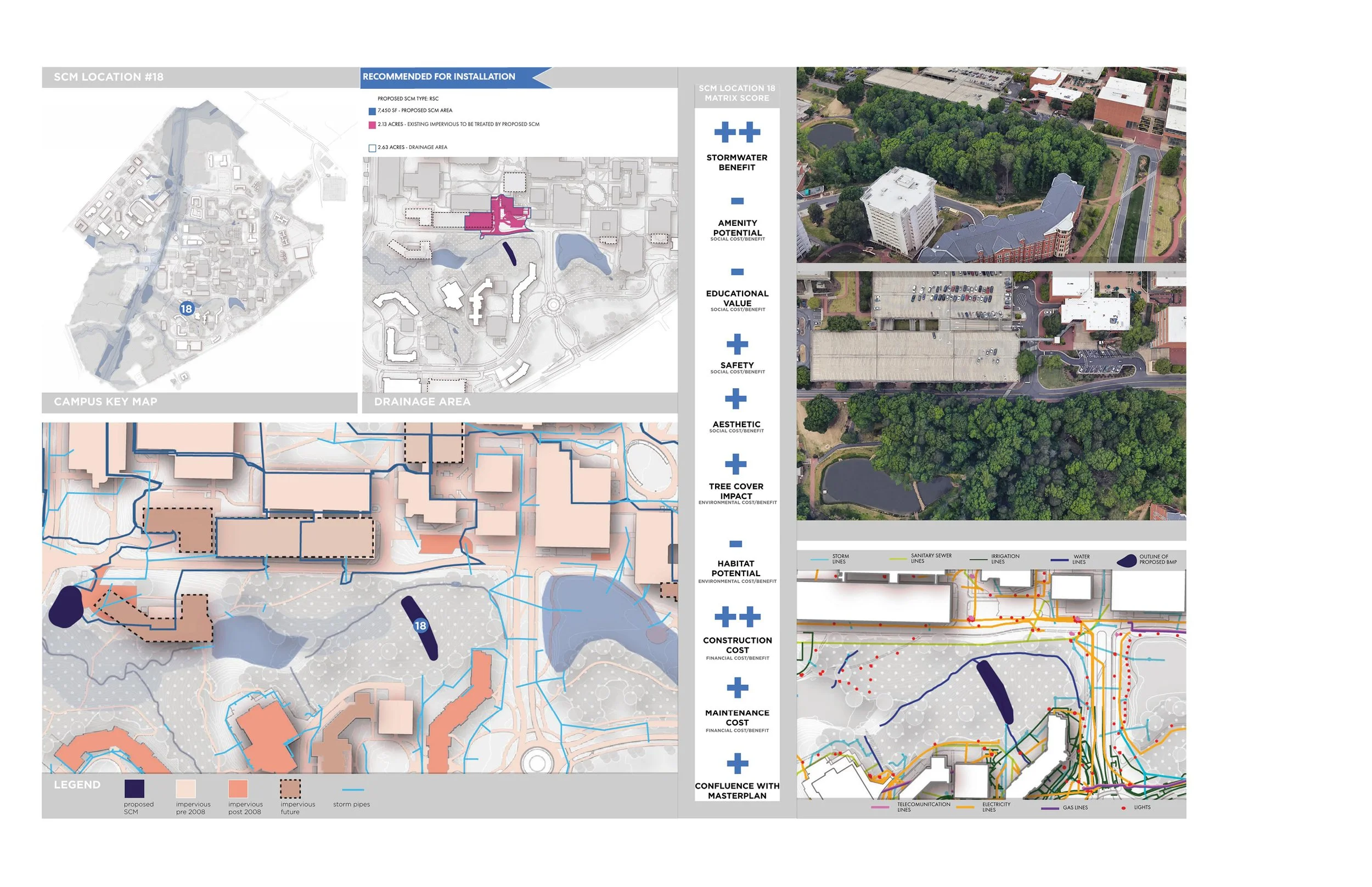
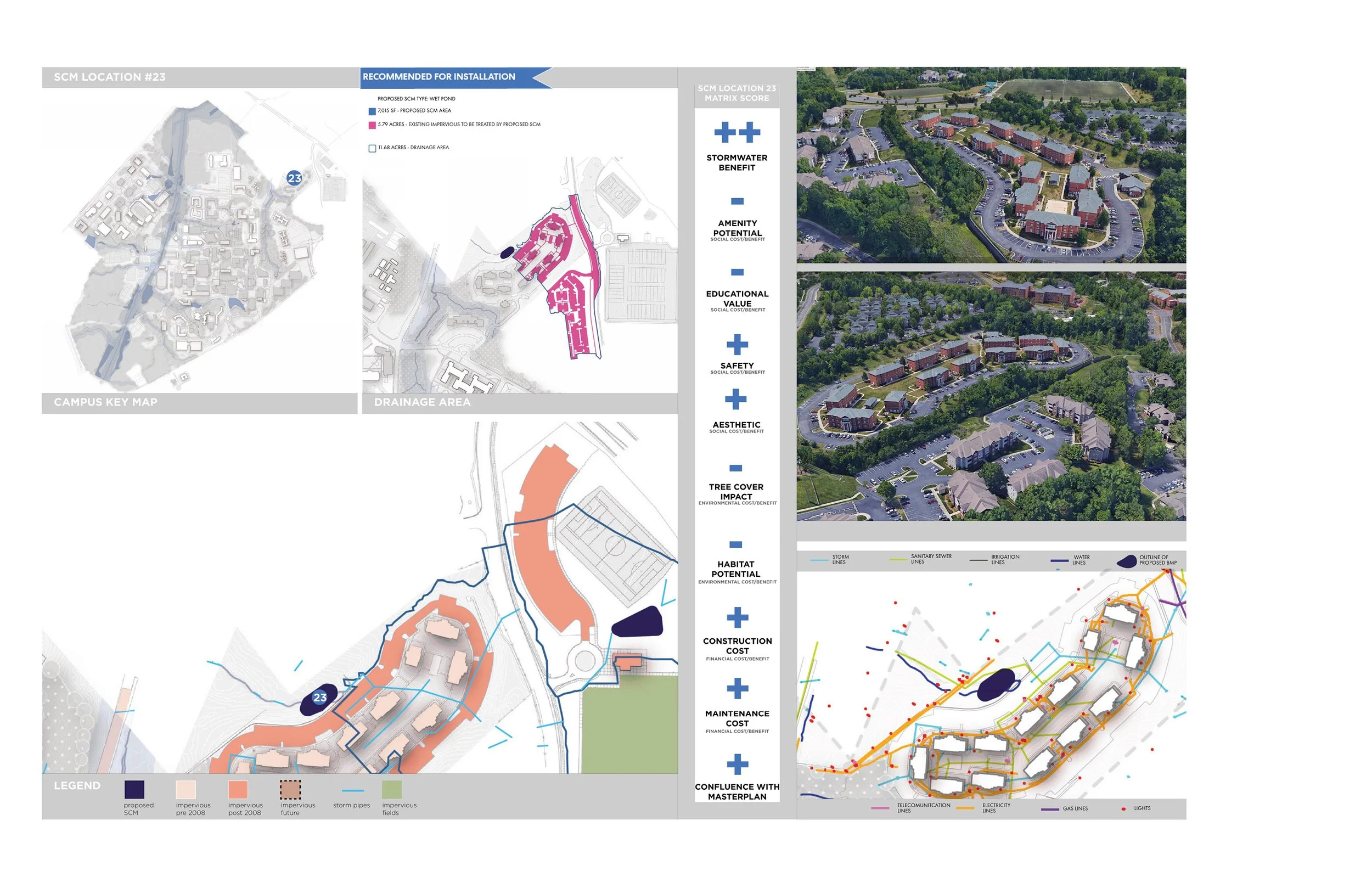
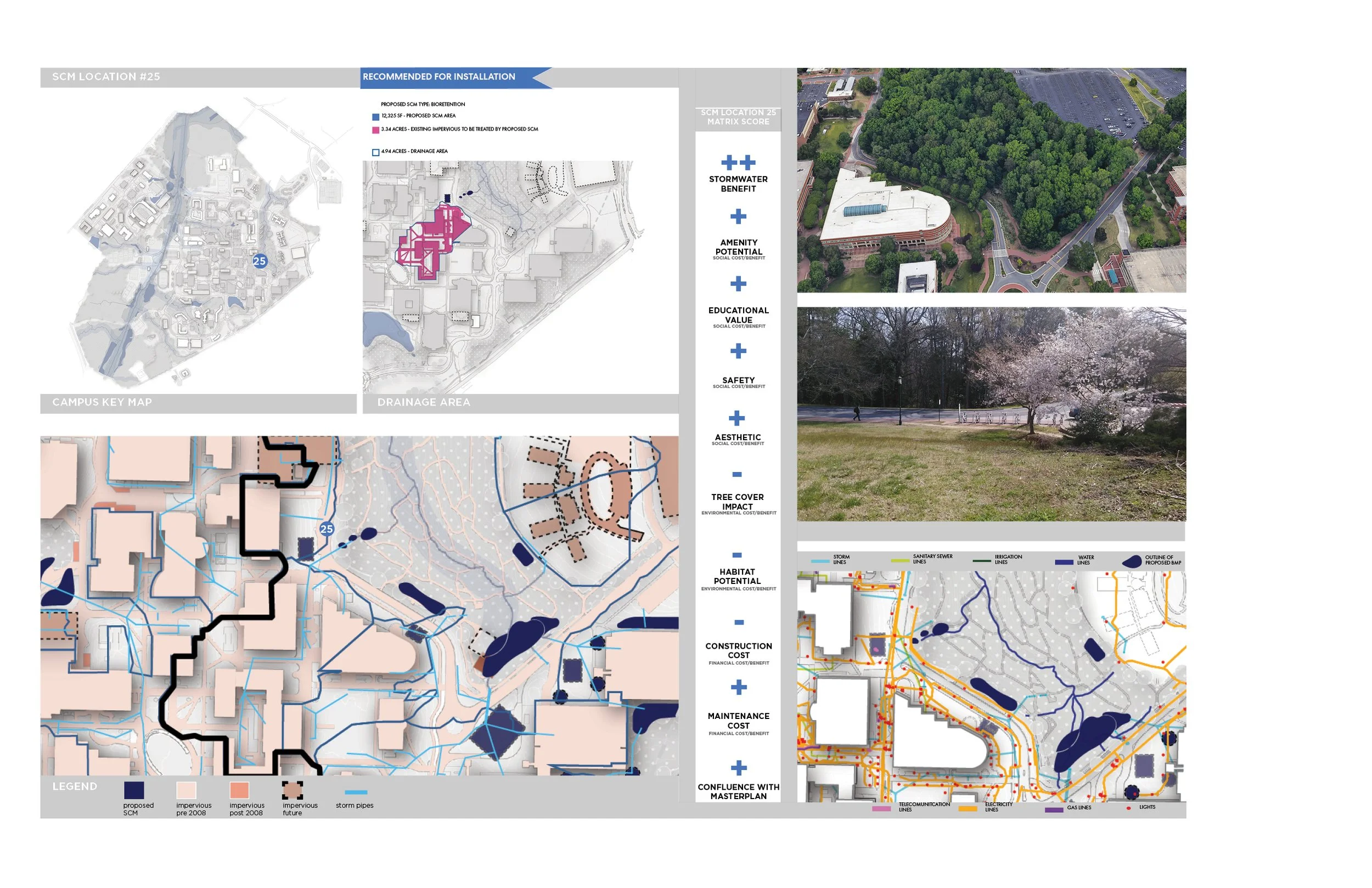
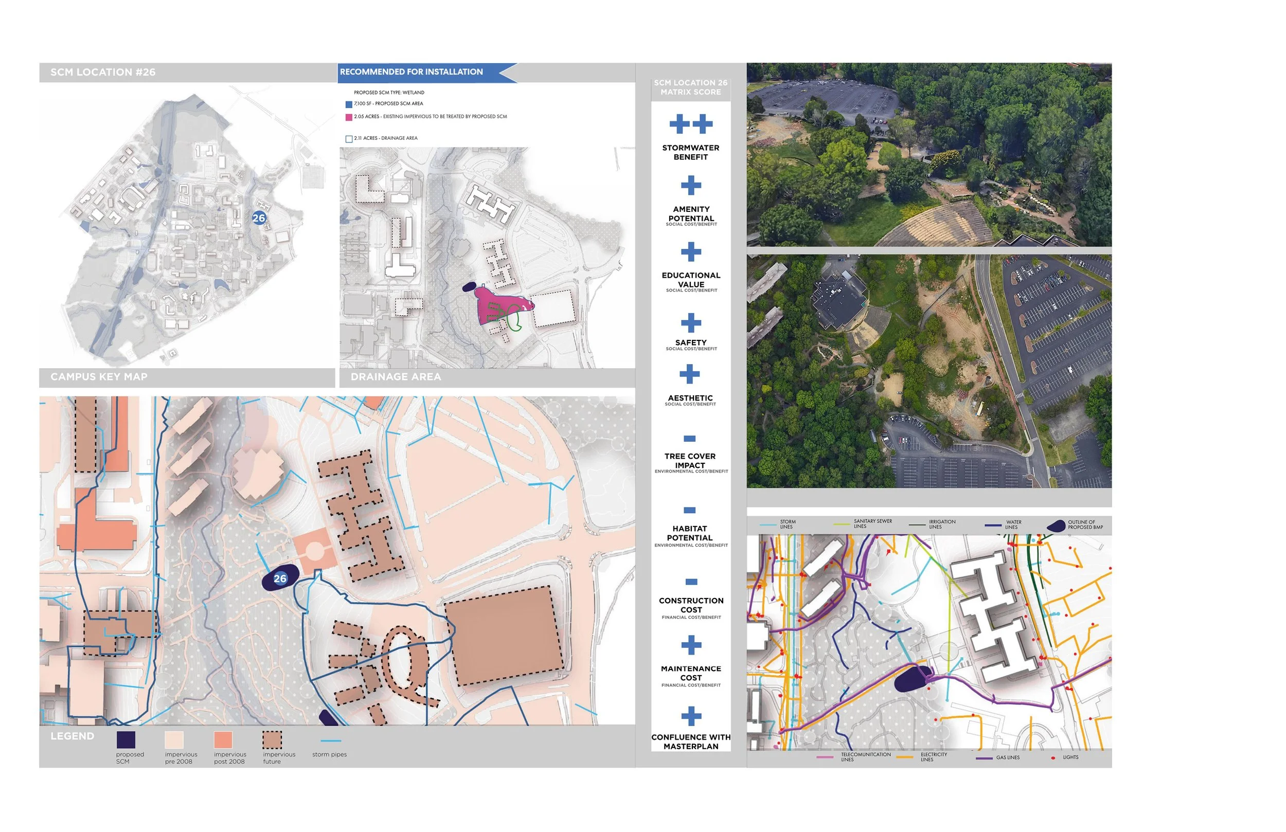
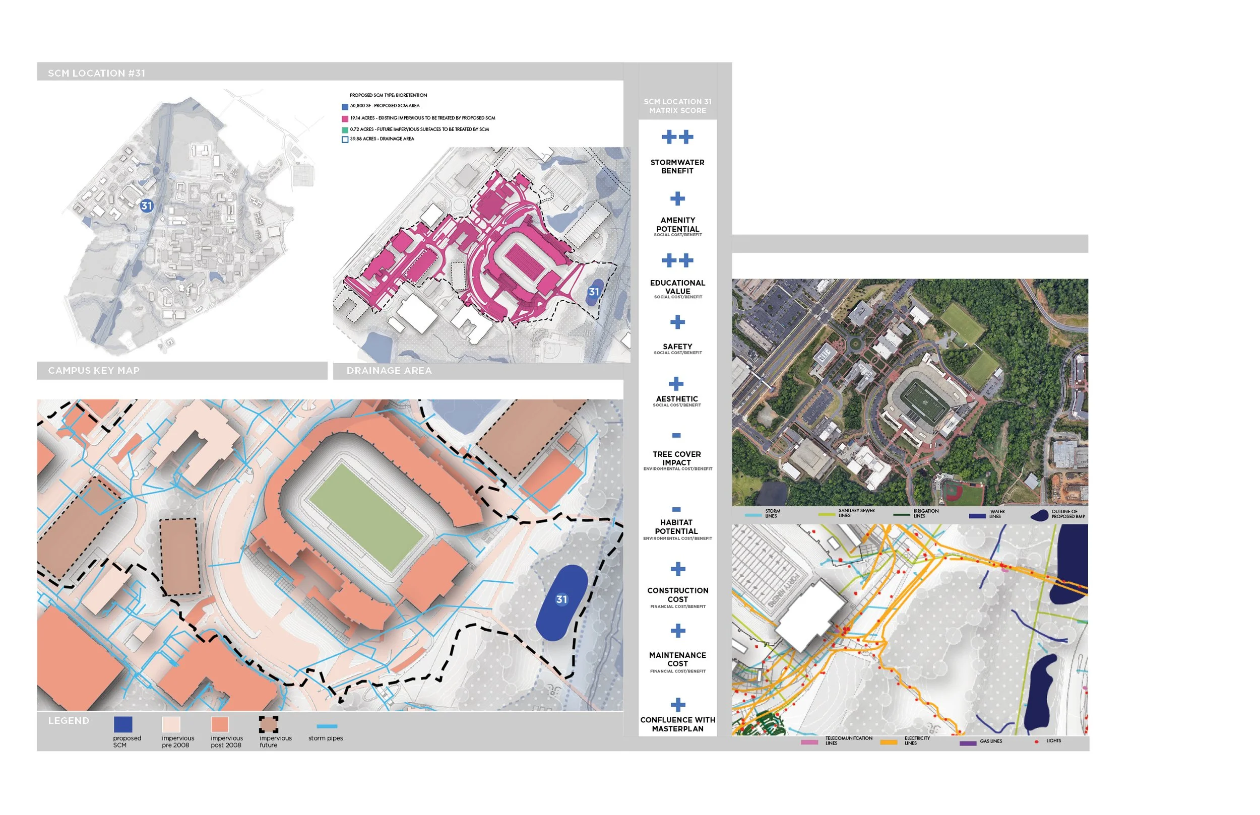
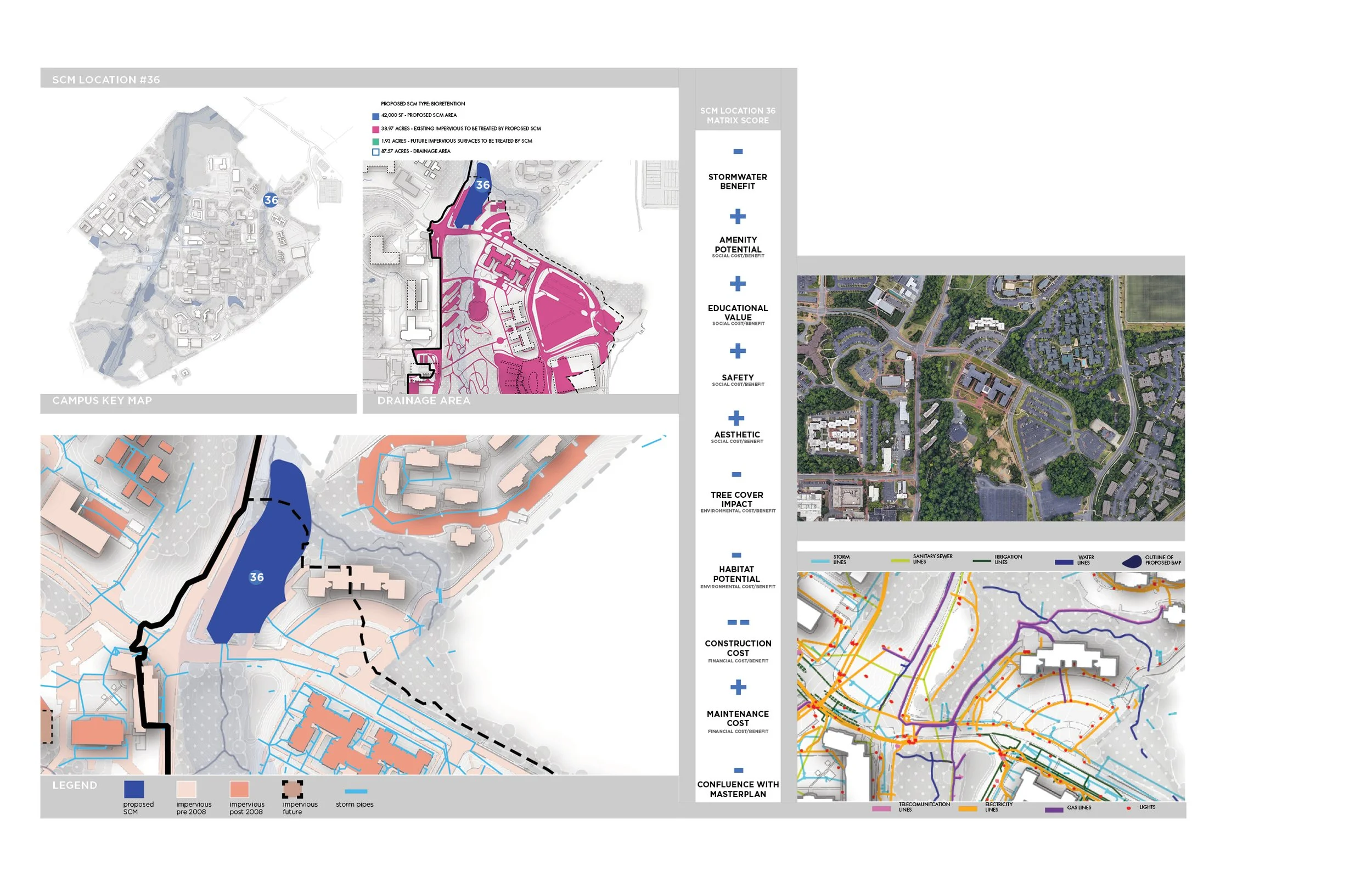
We identified over 50 potential locations for the installation of SCMs throughout campus. We picked these in close coordination with the engineering consultant. The locations studied were selected based on drainage areas that were calculated by the engineer using HydroCAD models. Each SCM studied treats a specific drainage area and the size of the SCM depends directly on the BUA within its drainage area. Additionally, the type of SCM affects the total area that the SCM occupies since different SCM types require different depths.
We identified local and regional SCMs. The regional SCMS are larger in area and treat multiple drainage areas. The installation of the regional SCMs studied have great potential to become amenity spaces as well as treat significant amounts of stormwater.
The impact of an SCM at each location was analyzed and evaluated according to several factors that are detailed in the section that follows.
THE SCM EVALUATION MATRIX
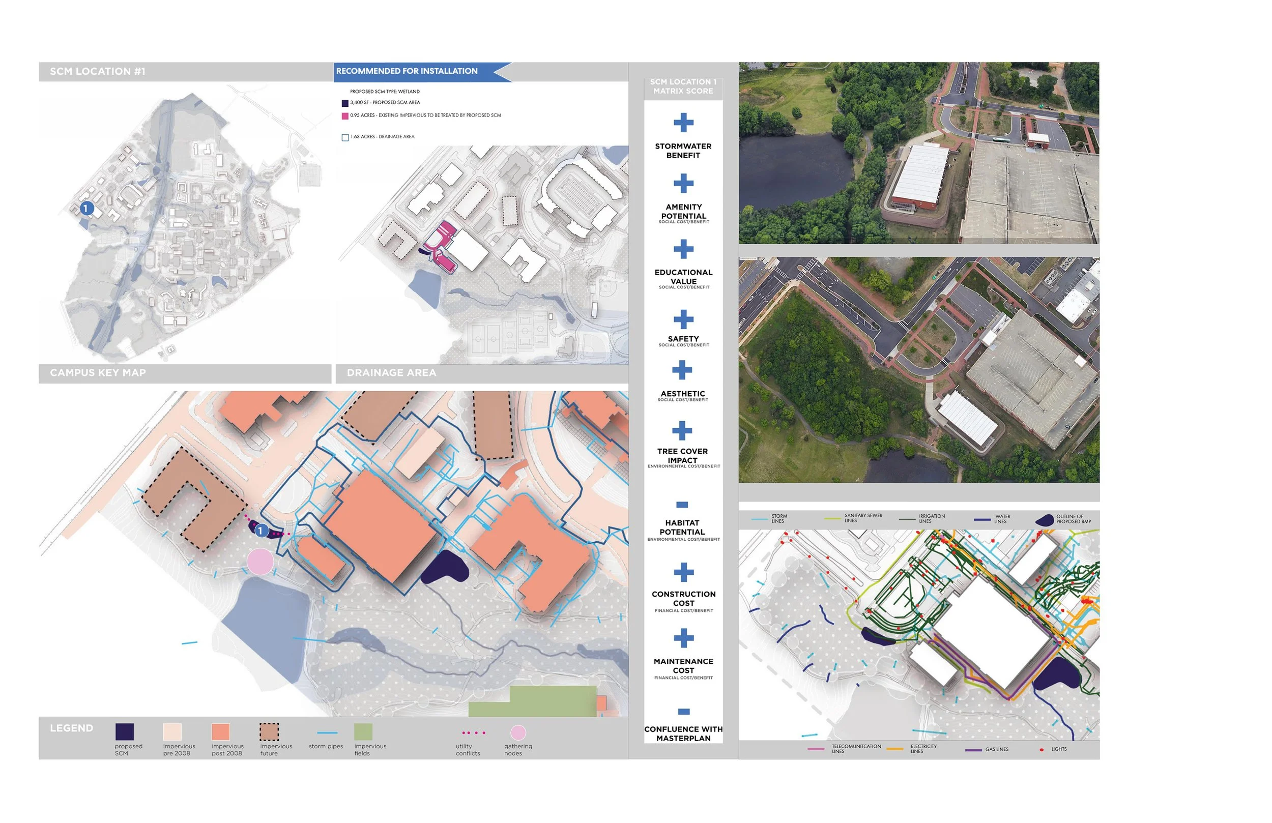
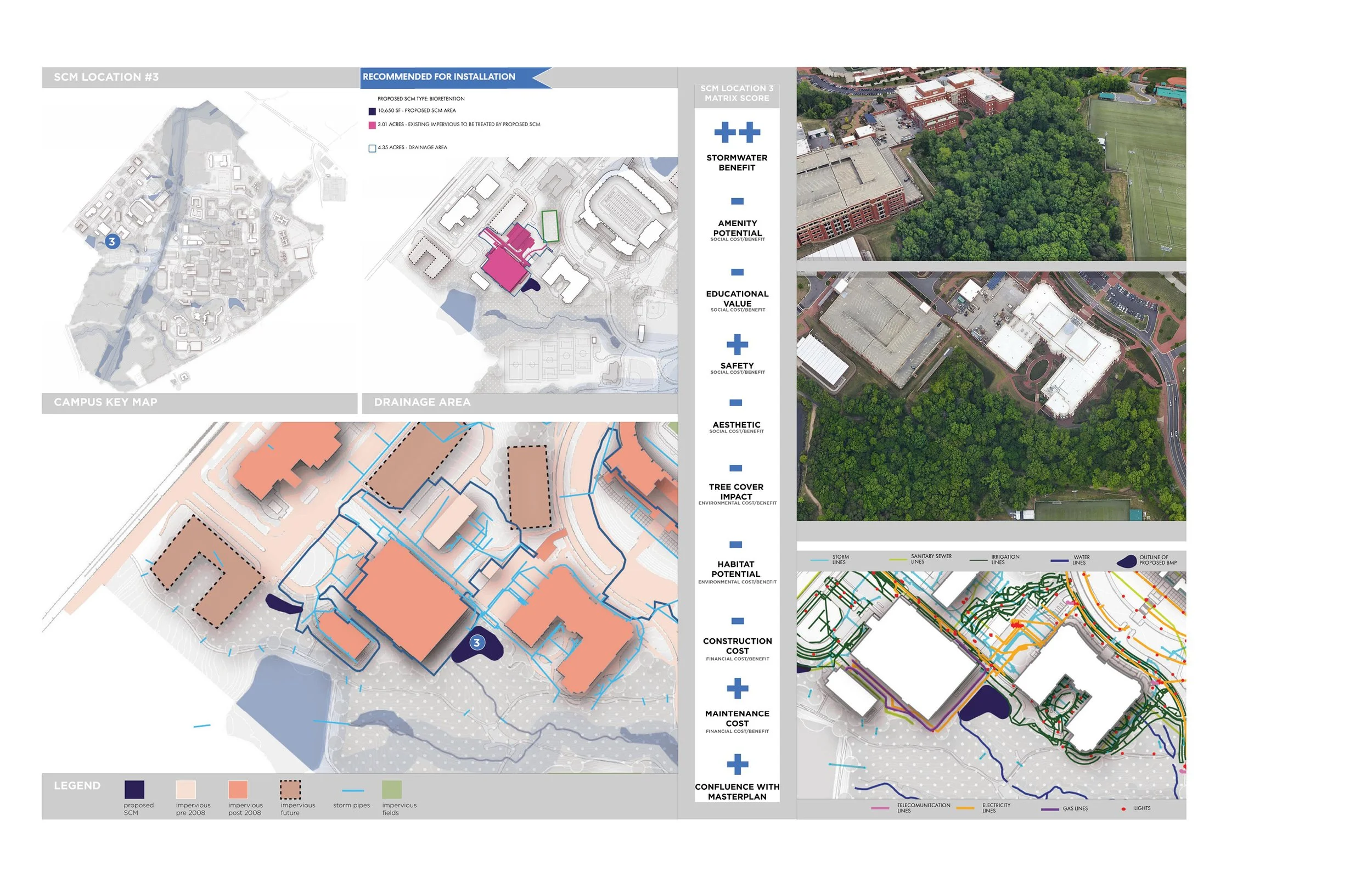
Each proposed SCM would occupy valuable real estate on campus, and the various locations available for their installation pose unique pros and cons. The next step in the process was to conduct a thorough site analysis that would inform the decision of which locations were best suited for SCMs. The potential SCM locations were then evaluated using a matrix that took into consideration 10 factors.
-
How much built upon area (BUA) does this proposed SCM have the ability to treat? What is the detention capacity of the proposed SCM? SCMs with a greater capacity to treat BUA and detain stormwater score higher in this category.
-
Are there existing sidewalks or greenways around the proposed SCM that make it easily accessible? Are there views from existing or proposed buildings of this area? Answers to these questions are considered in the amenity potential score.
-
Measured by the SCM’s potential ability to deliver messages to the public about the environment and natural systems employed in storm water management.
-
The presence of potential safety risks surrounding the SCM including steep slopes, deep water, or thick brush are considered in this score.
-
Does this area include beautiful natural features that could be leveraged in our design? For example, is there an old growth forest, a gentle creek, or a beautiful view from or towards this site? This factor is subjective, but nonetheless important to the design team.
-
Existing tree cover provides storm water management benefits in many ways, so a successful strategy would preserve and enhance tree cover. The value we assign to forested areas is determined by maturity, aggregate size, and composition of individual species. If the proposed SCM would adversely impact valuable forest, it does not get a high score in this category.
-
This category ranks development sites on potential habitat gained or lost. The potential to create new habitat from degraded or managed landscapes represents a potential gain, while disturbing an existing habitat represents a loss.
-
Which SCM gets more bang per buck? What is the ratio of stormwater benefit against construction cost? SCMs with the highest stormwater benefit potential and the lowest construction cost get the best scores in this category.
-
This factor is measured by man hours/ annual cost needed to maintain the stormwater management device or strategy.
-
The stormwater masterplan aims to be in sync with the existing campus masterplan. This includes all proposed campus and utility infrastructure. Additionally, an evaluation of the level of infrastructure improvements or potential utility conflicts associated with implementing construction of a SCM are considered.
TYPES OF RECOMMENDED STORMWATER CONTROL MEASURES (SCMS)
PRELIMINARY DESIGNS FOR SCMS
Once the best SCM locations were determined, we imagined what those spaces could be on campus. We did preliminary designs of some of our favorite options for SCMS that we recommended be installed on campus. This vision started with rough plan sketches and grading plans to digital drawings and 3D models in Rhino to photo-realistic renderings. The renderings were a useful tool in explaining the vision to the client. The plan renderings and perspective views of the envisioned SCMs had the university quite excited about the potential of these SCMs. Not only would they resolve the campus stormwater issue, but also serve as beautiful campus amenities that could offer spaces for rest and relaxation, while also improving habitat.
WEST CAMPUS BASIN
The total BUA (including future BUA) that needs to be treated in this basin per regulations is 76.34 acres.
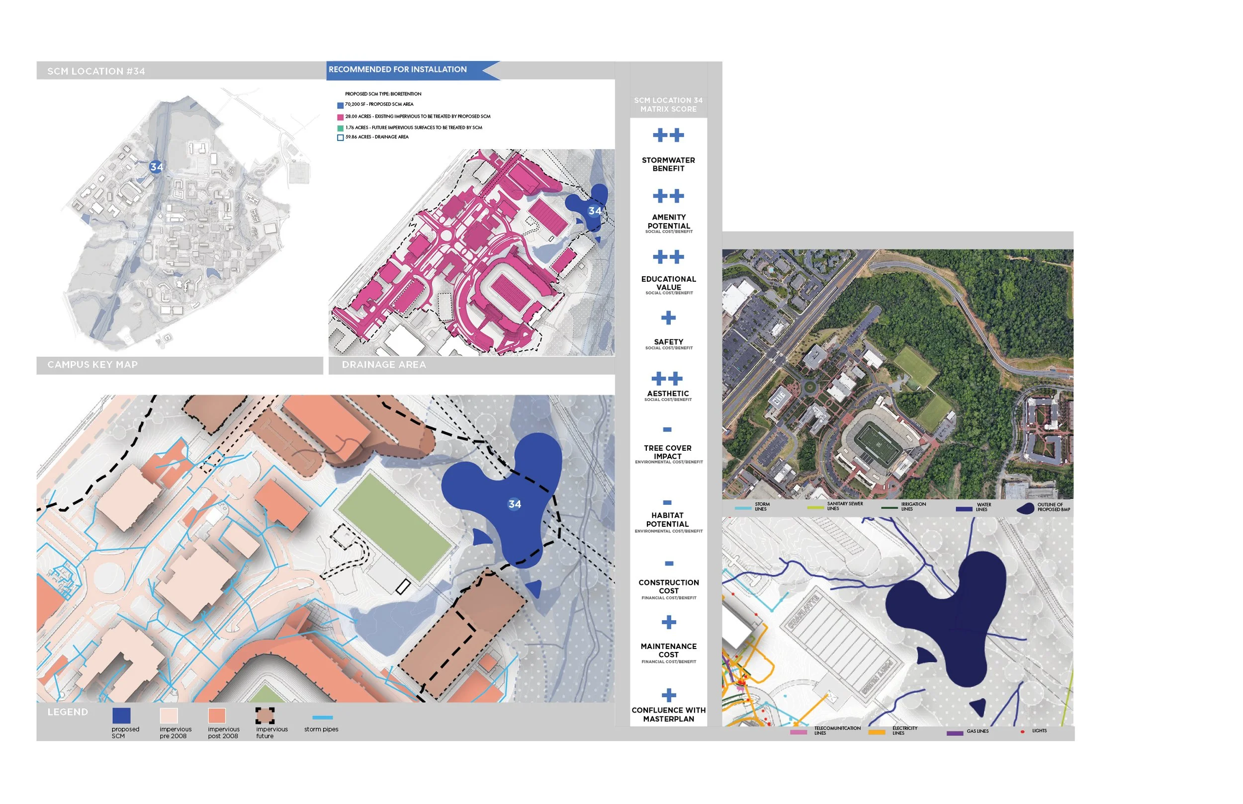
The recommended SCMs in this drainage basin include regional SCMs 32, 33 & 34 and several local SCMs. We specifically investigated local SCMs 19 and 21 because those options also had promising amenity potential. The 3 regional SCMs that are recommended for installation would treat much of the BUA that is required (46.61 of 76.34 acres) while also offering new trails, overlooks, boardwalks and outdoor learning opportunities. Besides this, these proposed SCMs would have a great restorative effect on Toby Creek.
REGIONAL SCM 34 - WET POND
WEST CAMPUS BASIN | REGIONAL SCM 34 – CRI CAMPUS POND
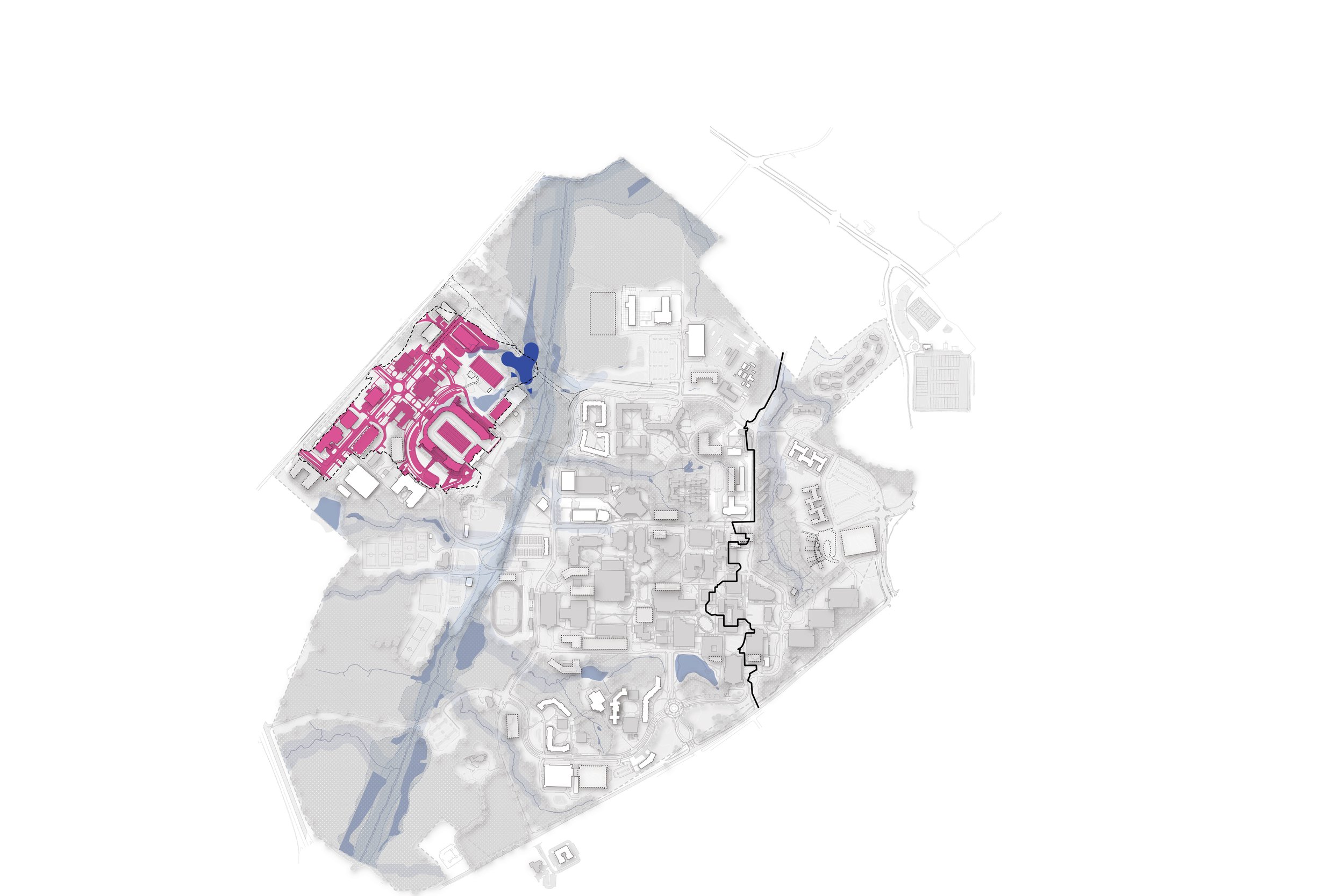
The Charlotte Research Institute (CRI) Campus Pond is a proposed regional SCM that aims to collect, detain, treat and convey stormwater within a nearly 40-acre watershed. The site for the pond is a low-lying area along the northern edge of the existing CRI campus development. It takes advantage of existing storm drainage infrastructure and existing topography in capturing stormwater. Besides the pond, the SCM would include a series of swales that collect runoff from multiple sources and direct stormwater into the pond where the water is treated for quality. The implementation of this SCM is recommended, however it is likely that it will require extensive permitting which may require stream and wetland mitigation efforts. Pedestrian trail loops, boardwalks and overlooks are envisioned surrounding the pond which also serves as a gateway feature for campus, especially with the future CRI road construction that is part of the masterplan.
REGIONAL SCM 32 - CONSTRUCTED WETLAND
REGIONAL SCM 33 - CONSTRUCTED WETLAND
PERSPECTIVE VIEW OF THE PROPOSED BOARDWALK - SCM 32
WEST CAMPUS BASIN |REGIONAL SCMS 32 & 33 - TOBY CREEK WETLANDS
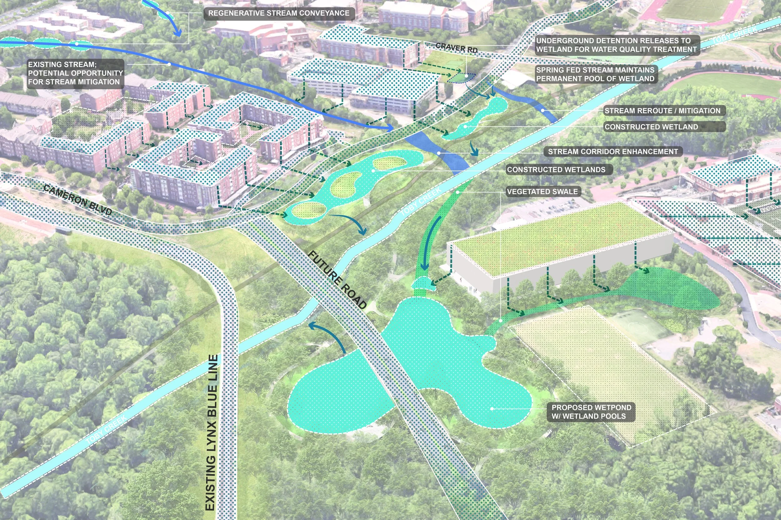
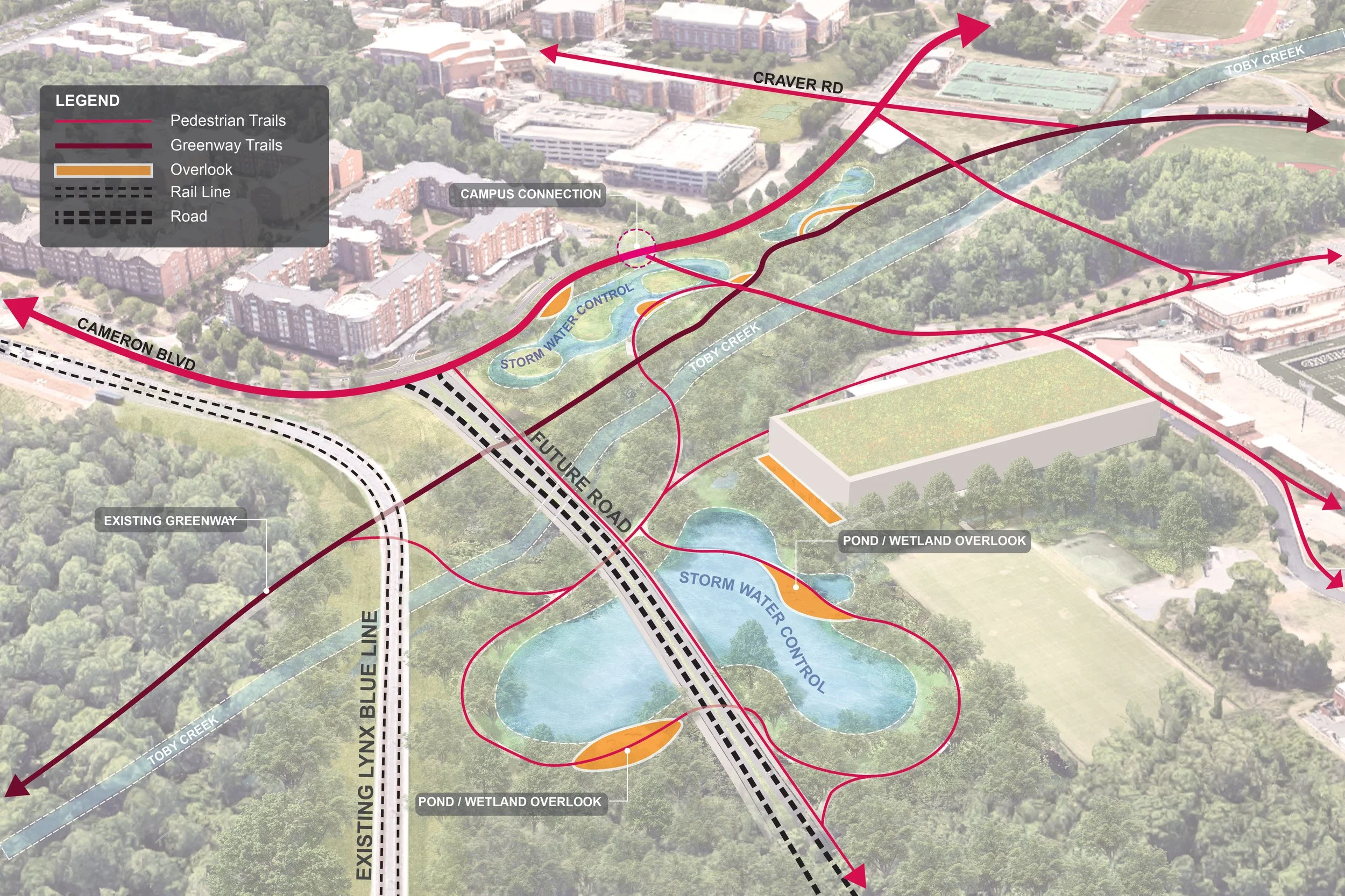
SCMs 32 and 33, which we are calling “The Toby Creek Wetlands” are highly recommended for implementation. The design team went as far as to produce a preliminary conceptual design for these wetlands because we saw this intervention as beneficial to the campus in many ways. The feature is envisioned as two constructed wetlands bisected by a restored stream channel. Realized in tandem, these wetlands would help restore Toby Creek and would transform the creek’s eastern banks into a prized stormwater feature.
The site is positioned in a low-lying area subject to floodplain regulations which restricts future development on the site. Because of the site’s sunken position, it is natural spot for existing stormwater pipe outfalls. Placing the feature at the pipes outlets optimizes its efficiency. One of these SCMs would incorporate an existing underground detention device which would be used to control the release of stormwater into the constructed wetland where it would be treated. This controlled release of detained stormwater as well as a portion of the restored stream channel’s base flow can be used to provide a “charge” on the SCMs which allows them to function as a wetland. Aside from the stormwater benefit, these wetlands are positioned alongside an existing greenway, making it a perfect spot for an amenity. The conceptual design envisages the wetlands surrounded by strategically placed overlooks and boardwalks that offer pedestrians opportunities to engage with the landscape. Interpretive signage would highlight the biological systems at work within the transformative landscape and the use of a varied and native planting palette would promote a more diverse ecosystem and wildlife corridor.
A note on the graphics in this section: above are some of my own hand sketches and illustrator drawings. The renderings to the left were a team effort between Zhouying Chen and I. We were constantly checking in with Robert Pratt for feedback. I made grading plans for the proposed SCMs based on calculations from the engineer, who told us how big and how deep each SCM needed to be. With this information I modeled the SCMs in Rhino 3D. Zhouying and I then worked together using a combination of Adobe Illustrator and Photoshop to produce the plan and perspective renderings you see to the left.
WEST CAMPUS BASIN | LOCAL SCMS - ATKINS LIBRARY STORMWATER OVERLOOK
This proposed local SCM takes the form of terraced bioretention pools that navigate the existing steep slopes on the ground north of Atkins Library. They are envisioned as delicately integrated with their surroundings, which include frequently used campus buildings, existing open spaces, and important pedestrian corridors. The design suggests an exciting landscape that’s welcoming to people on campus.
The proposed terraces would deal with the runoff from close to 7 acres of untreated BUA from buildings, quads, and plaza spaces within the drainage area. Each level of the terraces would function as a tray that releases stormwater gradually over a series of boulder walls. The design could also incorporate underground detention beneath pedestrian pathways to prepare for major storm events.
WEST CAMPUS BASIN | LOCAL SCMS - SACS STORMWATER TERRACES
The design team proposed a stormwater integrated quadrangle by the Student Activity Center (SACS). This stormwater feature could be designed so that runoff from the rooftops of surrounding buildings is collected and conveyed to an underground detention device beneath the quad. Next, the design would leverage the existing topographical changes on site and would re-purpose the steep slopes as bioretention terraces that would treat a slow release of the detained stormwater water for quality. The design would also incorporate permeable pavements to improve tree growth and health in an urban environment that often makes it difficult for trees to thrive.
The terraces would double as outdoor seating areas that create an enjoyable new gathering space for people where they are immersed in a functional, sustainable landscape.


EAST CAMPUS BASIN
The total BUA (including future BUA) that needs to be treated in this basin per regulations is 5.81 acres. The amount of BUA in this area is expected to decrease after the Master Plan’s full buildout. This is because there are currently various impervious parking lots on site that will be developed into buildings with accompanying green spaces in the future.
The SCMs recommended for installation in this drainage basin are concerned with much more than achieving regulatory compliance. Treating 5.81 acres of BUA in this area is fortunately quite easy to do with an SCM device such as a bioretention area. The concern regarding this area, however, is the flash flooding that occurs during storm events. The primary goal of the design team for this area is to address the flooding issue through a series of SCMs that work to detain stormwater during major storm events and release the stormwater in a controlled manner while treating it for quality.
BOTANICAL GARDENS SCMS
EAST CAMPUS BASIN |BOTANICAL GARDENS AREA IMPROVEMENTS
Due to increased development over the years, the botanical gardens area faces major stormwater issues. The increased amounts of impervious surfaces upstream of the gardens has created a flood hazard for the area during heavy rainfall. Runoff from various points enter the garden channels where the converging flows transform into a raging torrent that damages the gardens and degrades the stream channel. Of course, this issue also presents a health and safety hazard within an area that is meant to be for people to enjoy.
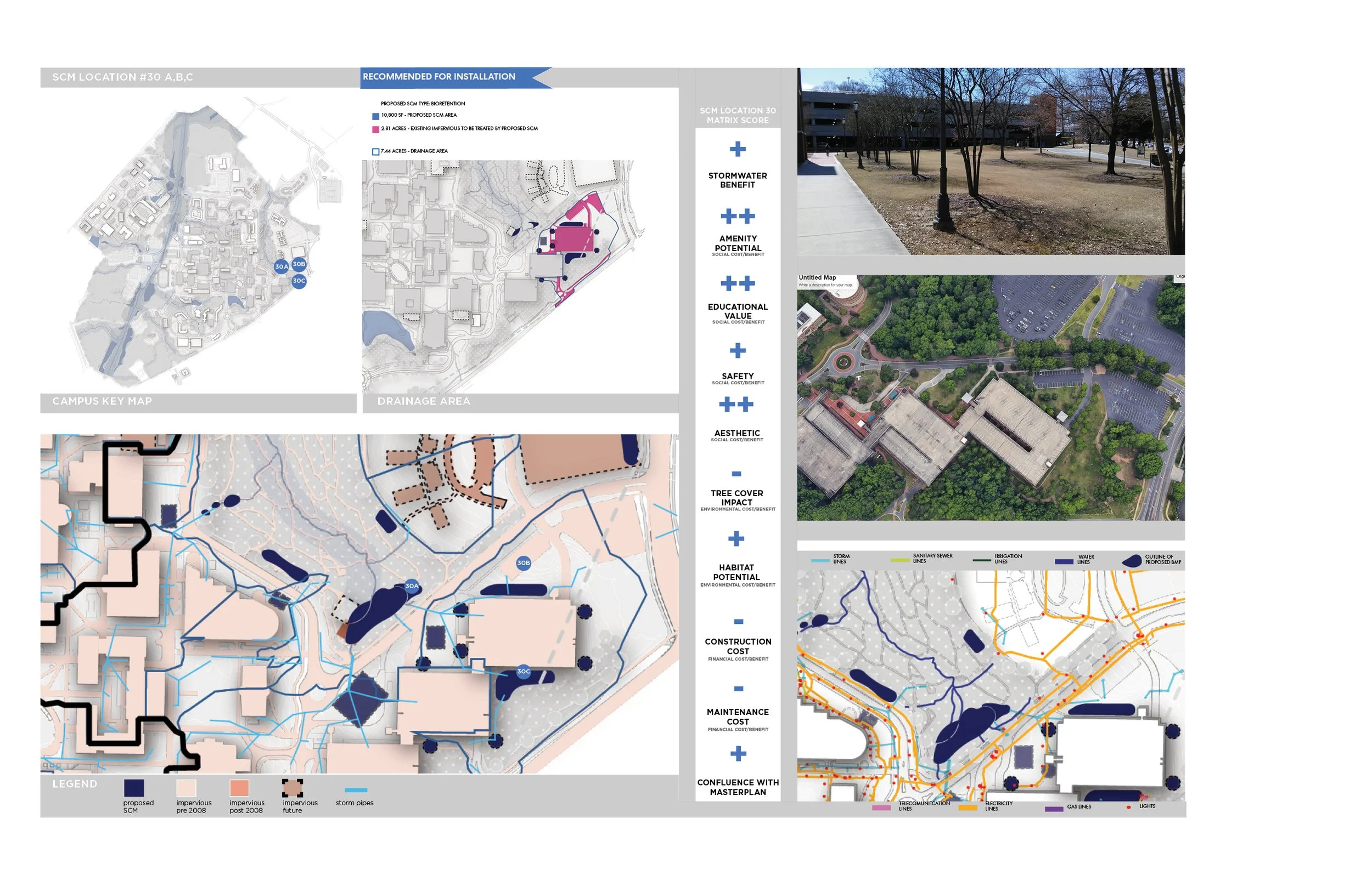
The botanical gardens stormwater improvements are envisioned as an integration of multiple SCMs. (Specifically, SCMS #25, 26, 27, 29, 30A, 30B, and 30C). The first goal of these SCMs is to protect the garden from strong torrents and flooding by providing stormwater detention areas that would capture the stormwater from a 25-year storm event. The detention devices would be a combination of above ground and below ground installations. Next, the detained stormwater would be slowly released into a series of bioretention devices and ponds within the gardens that would treat the stormwater for quality. These would also serve as amenity spaces that would have trails and overlooks surrounding them.
The proposed SCMs also integrate with the campus Master Plan’s vision for the botanical garden, which includes the future development of a Children’s Garden and a Garden Center. The design team imagines a future condition where the proposed SCMs are a showcase of green infrastructure where the integration of multiple methods of stormwater detention and harvesting, as well as methods of treatment in the form of constructed wetlands, terraced bioretention, and green roofs would be on display.
It must also be noted that existing degraded streams in the botanical gardens area would be impacted by the proposed SCMs and future development. This means that stream mitigation will be required. The design team recommends considering on-site stream mitigation in the area directly downstream of the proposed SCMs.

Botanical Gardens SCMs - Phase I

Botanical Gardens SCMs - Phase II

Botanical Gardens SCMs - Stormwater Diagram

Botanical Gardens SCMs - Amenity Diagram
NE RECREATIONAL FIELDS BASIN
The Northeast Recreational Fields are located along the north side of John Kirk Drive. There is an existing underground detention pipe beneath the south fields as well as a small dry detention basin close to Mallard Creek.
The proposed stormwater management solution in this drainage basin involves the installation of bioretention SCMs to address the two northernmost drainage areas. For the southern drainage area, the design team recommends that the existing underground detention device be expanded since there is limited space above ground. A water treatment system would need to be implemented in conjunction with the expanded detention device to ensure that water quality requirements are met before the stormwater is released. If implemented strategy would address the 12.80 acres of BUA that need to be treated within this drainage basin.

